 AICSM established a UAV and UAS Centre for Environmental Monitoring and Mapping (UCEMM) in 2014 to provide advice and support to current and future users of Unmanned Airborne Vehicles (UAV) (often referred to as Unmanned Airborne Systems (UAS), or Drones) e.g. quadcopters and fixed wing aircraft.
The Centre is currently involved in the acquisition of remotely sensed data and imagery (still and video) from UAVs using small drone platforms (including quadcopters and microdrones) carrying a variety of small airborne sensors e.g. cameras (GoPro, MapIR, IRPro, FLIR, Parrot Sequoia, MicaSense RedEdge, and DSLR) and other instruments such as Lidar. We also utilise ground-based and water-borne remotely operated and piloted vehicles to provide a complete air/land and water interface.

David R. Green (Director)
Current applications of our UAVs include
- Vineyard Monitoring and Mapping
- Medical/COVID-19/Pandemic
- Sustainable Urbanisation
- Carbon Capture
- Hydrological Monitoring and Mapping
- River Habitat Monitoring and Mapping
- Coastal Monitoring and Mapping
- Saltmarsh Monitoring and Mapping
- Fruit Fly Monitoring (Precision Horticulture)
- Geological Applications
- Archaeological Site Mapping
- Oil and Gas Pipeline Monitoring
Software includes
- Photoshop
- GIMP
- ImageMagick
- AgiSoft
- AirphotoSE
- Pix4D
- BlueMarble Global Mapper
- WebODM
UAV Platforms
- Multirotor
- Fixed Wing
- Underwater
New Projects
Precision Horticulture
![]()
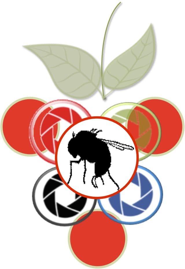
AAPM: Automated Airborne Pest Monitoring (AAPM) of Drosophila suzukii in Crops and Natural Habitats:
AAPM Presentations
Presentation 1 (AHDB Workshop - David R. Green)
Presentation 2 (AAPM Meeting (2018) - Peter Roosjen)
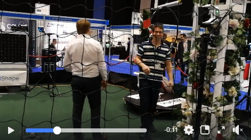
Dr. Johannes Fahrentrapp (ZHAW PI on the AAPM project) with Billy J. Gregory (AAPM Field Assistant) testing the DJI Mavic 2 Pro Hasselblad (20MP) camera with some sticky fly traps in the flying cage at the Commercial UAV Show - ExCel Centre, London - on the 15th November 2018. Click Here for the short video clip
Coastal and Marine
![]()
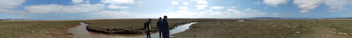
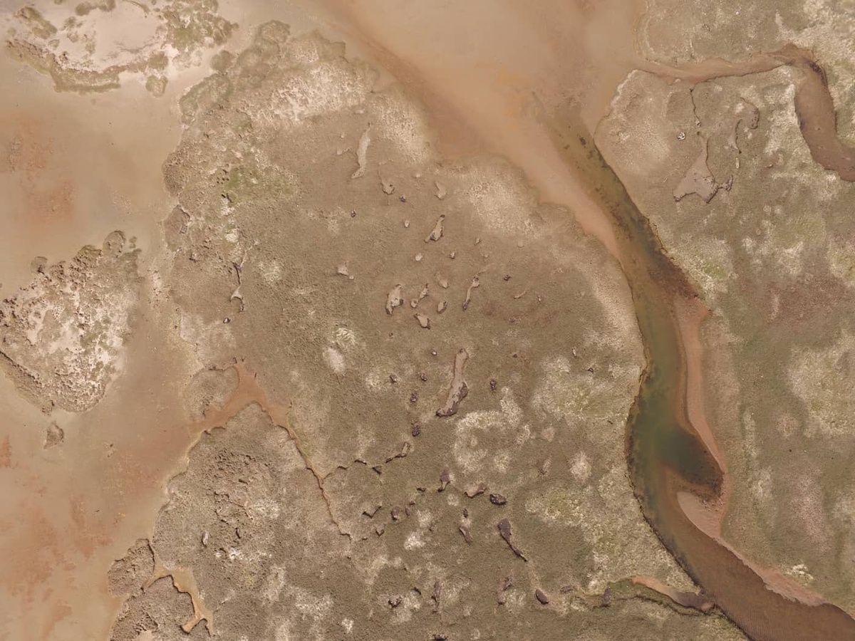
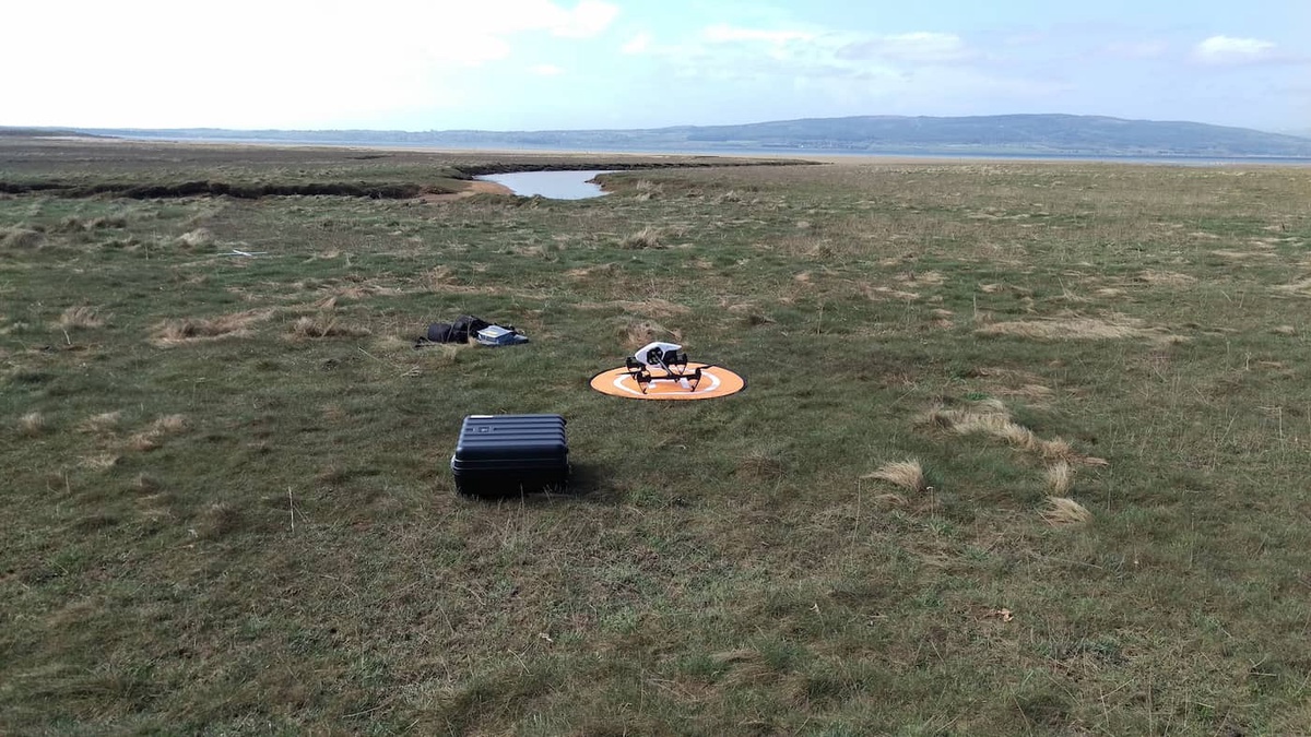
MASTS 1: UAV Remote Sensing for Spatio-Temporal Monitoring of Phenological Change of Saltmarsh Vegetation
MASTS 2: Oil and Gas Pipeline Installation Monitoring, Modelling (OGPIMM) in the Coastal Zone/Marine Environment
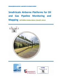
Gomez and Green (2014). Small-Scale Airborne Platforms for Oil and Gas Pipeline Monitoring and Mapping . Unpublished Report for Redwing Ltd. 56p.
Gomez and Green (2017): Small Unmanned Airborne Systems to Support Oil and Gas Pipeline Monitoring and Mapping. Arabian Journal of Geosciences. Vol. 10(9):1-17.
KTP (Knowledge Transfer Partnership)
![]()
To research, design, develop, implement and evaluate a digital strategy embedding the knowledge to transform a significant 140 year old traditional rural co-operative business. (with: ANM Group, Business School and Computing Science at the University of Aberdeen)
Live Video Streaming of Market events via UAV-mounted video camera (Inspire 1):
YouTube Video of Thainstone specialist auction of plant, machinery and equipment January 21st 2017.
David R. Green | Ian Heywood | Bruce Scharlau | Kostadin Sorchev (Research Assistant)
First Flight of the Parrot Disco at Knock Farm, Huntly
Thursday 10th August 2017 - the maiden flight of our first Fixed-Wing aircraft - a Parrot Disco.
Coastal Monitoring, Mapping and Videography
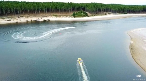
(Billy Gregory | DJI Mavic Pro | Findhorn, Scotland, UK | August 2018)
PhD Projects
Andrew E. Smith (Geography/SBS): Mapping, monitoring and modelling coastal habitats with UAVs (MASTS SNH/Geography/SBS)
Reports & Articles
- Green, D.R., Gregory, B.J. et al. 2018. Low-Cost UAVs for Coastal Monitoring, Mapping and Modelling. Paper/Poster Presentation: CoastGIS 2018 (Sept - Iceland) | Commercial UAV Expo (Oct - Las Vegas, USA) | Littoral 2018 (Oct - Leeuwarden, The Netherlands) | MASTS 2018 - (Nov - Glasgow, Scotland) | (Nov - Commercial UAV Show - London)
- Green, D.R., 2018. Coupling UAV and Hydraulic Surveys to Study the Geometry and Spatial Distribution of Aquatic Macrophytes. Journal of Ecohydrualics (with Biggs, H., Nikora, V., Gibbins, C., Fraser, S., Papadopoulos, K., and Hicks, D.) Vol 3(1):45-58.
- Gomez, C., and Green, D.R., 2017. Small-scale Unmanned Airborne Platforms to Support Oil and Gas Pipeline Monitoring and Mapping. Arabian Journal of Geosciences. Vol. 10(9):1-17.
- Green, D.R., 2017. Use of Automatic Digital Photogrammetry to support and assess river restoration projects. (with Marteau, B., Vericat, D., Batalla, R.J., Green, D.R. and Gibbins, C.N). Earth Surface Processes and Landforms. Volume 42, Issue 3:503-515
- Green, D.R., 2017. Photogrammetry Aids Restoration of an Ecologically Important River. Geomatics World. March/April 2017. pp.14-17. (with Marteau, B., Gibbins, C., Vericat, D., and Batalla, R.)
- Green, D.R., 2017. Modelling a Vineyard Canopy with UAV Imagery. Geomatics World. January/February 2017. pp. 27-29.(with Luca Zanchetta)
- Green, D.R., 2017. River Habitat Monitoring and Mapping with a UAV. GIS Professional. Issue No. 73: December 2017:24-26. (with Peck, R., Gibbins, C., and Greig, M.)
- Green, D.R., 2016. Drones a Useful Survey Tool? Water and Sewerage Journal. Issue 4/2016. p. 27.
- Biggs H., Nikora V., Gibbins C., Green, D.R., Fraser S. and Papadopoulos K. , 2016. Flow-vegetation interactions at the patch mosaic scale: Coupling hydraulic measurements with aerial imagery of patch distributions. International Symposium on Interfaces with Aquatic Ecosystems. August 2016. 30th August 2016.
- Green, D.R., 2016. Changes in physical habitat in an ecologically important upland river following tributary reconnection (with Baptiste Marteau, Damià Vericat, Ramon J. Batalla, Chris Gibbins, David Green). Proceedings of 11th International Symposium on Ecohydraulics, Melbourne, Australia. February 7th-12th 2016.
- Green, D.R., 2015. Physiological Differences in Highly Fragmented Vineyards Using NIR/RGB UAV Photography. Proceedings of GIESCO, 19th GiESCO Day 31st May 2015 to 5th June 2015, Gruissan - France.(with Johannes Fahrentrapp, Martin Häfele, Peter Schumacher, Cristina Gomez).
- Green, D.R., 2015. Airborne and Ground-Based Platforms for Data Collection in Small Vineyards: Examples from the UK and Switzerland (with Johannes Fahrentrapp and Cristina Gomez). Proceedings of European Geosciences Union. General Assembly 2015. Vienna | Austria | 12 - 17 April 2015.
- Green, D.R., 2015. Geomorphological evolution of a newly restored upland temporary stream (with Baptiste Marteau, Ramon J. Batalla, Chris N. Gibbins and , Damià Vericat). Proceedings of European Geosciences Union. General Assembly 2015. Vienna | Austria | 12 - 17 April 2015.
- Green, D.R., 2015. Geomorphological evolution of a newly restored upland temporary stream (with Baptiste Marteau, Ramon J. Batalla, Chris N. Gibbins and , Damià Vericat). Proceedings of HydroEco'2015 Vienna | Austria | 13 - 16 April 2015.
- Interface Report. UAVs for Beach Monitoring and Mapping: integrating aerial and ground survey
- Interface Report for Redwing Aero: Small-Scale Airborne Platforms for Oil and Gas Pipeline Monitoring and Mapping (Gomez and Green, 2014)
- Preserving a Fragile Marine Environment: Integrating Technology to Study the Ythan Estuary Mapping Awareness magazine article
- Grape Expectations - Digital Data in the Vineyard. GIS Professional Magazine
- Small-Scale Airborne Data Acquisition Systems to Monitor and Map the Coastal Environment. Paper/Poster Paper for the Marine and Coastal Environments Conference - San Diego, U.S. (October 1998). (Paper published in Proceedings. Volume 1: 439-449). (Contact d.r.green@abdn.ac.uk )
- Acquiring Environmental Remotely Sensed Data from Model Aircraft for Input to Geographic Information Systems. In Proceedings AGI'94 Conference. November 15th-17th 1994. pp. 15.3.1-15.3.28. (Contact d.r.green@abdn.ac.uk )
- Using Remote Sensing and Geographical Information Systems (GIS) to Monitor and Map the Distribution of Algal Weed Mats in the Ythan Estuary, NE Scotland (Poster)
Books
Green, D.R., Gregory, B.J., and Karachok, A. (2020) Unmanned Aerial Remote Sensing: UAS for Environmental Applications. Taylor and Francis/CRC Press.
UAV/UAS Guidelines, Rules and Regulations , Safe Operation, UAV Operation and Insurance Information
The best source of official information for UAV Operations is the CAA (Civil Aviation Authority)
Relevant and Authoritative information on all aspects of UAVs can be found here: http://www.caa.co.uk/default.aspx?catid=1995
UAV Insurance: http://www.uavs.co.uk/
Risk Assessment Forms
These are available from each of the Commercial Operators who fly drones for us.
Associate Members
- Samuel McMillan (Geography - University of Aberdeen / DroneLite)
- Alistair Skitmore (Skyports)
- Billy Gregory (DroneLite, Scotland, UK)
- Alex Karachok (School Education - Oakville, Ontario, Canada)
- John Cleave/Harvey Mann | Buzzflyer Ltd. (England, UK)
- Jason J. Hagon | Geodrone Survey Ltd. (England, UK)
- Brian Critchley/Dave Harrison| Geo4D/AlphaGeo UK (England, UK)
- Ruben de Vries | Van Hall Larenstein University of Applied Sciences (The Netherlands)
- Jan Ekebom | Ministry of the Environment of Finland (Finland)
- Johannes Fahrentrapp | ZHAW (Switzerland)
- Cristina Gomez | AICSM (Scotland, UK)
- Phil McLachlan | D-Cat. (Scotland,UK)
- Blanca Payas Puigarnau | Sixense-Group (Barcelona, Catalonia, Spain)
- Mike Mawby | Ops Input Limited (Scotland, UK)
For further information, please contact David R. Green: d.r.green@abdn.ac.uk
  |
||
 |