UKRI (NERC)
The UK Research and Innovation (UKRI) is the UK's leading public funder of environmental science, supporting research on Earth, atmospheric, marine, and polar sciences.
The 2nd chapter of the 2019 Intergovernmental Panel on Climate Change’s (IPCC’s) Special Report on the Ocean and Cryosphere in a Changing Climate, for the first time detailed the critical condition of socio-environmental systems in mountains, and highlighted the ever-increasing need for interdisciplinary collaborations to bring socioeconomic (SE) and critical infrastructure (CI) perspectives within conventional physical hazard impact assessment models. While the global SE vulnerability to climate-related hazards may have diminished, this decrease is spatially heterogeneous, i.e., the exposure to, and frequency of, hazards have increased and are highest for events such as landslides and cascading hazards, prevalent in high-mountains. This project aims at developing an interdisciplinary analytical framework for identifying and assessing the risks to communities and CI from landslides and cascading glacial hazards. While the framework will be applicable to any high-mountain region, we will implement and test it for Bhagirathi and Bhilangana Valleys, known for their hydrological, hydropower, touristic, and religious significance.
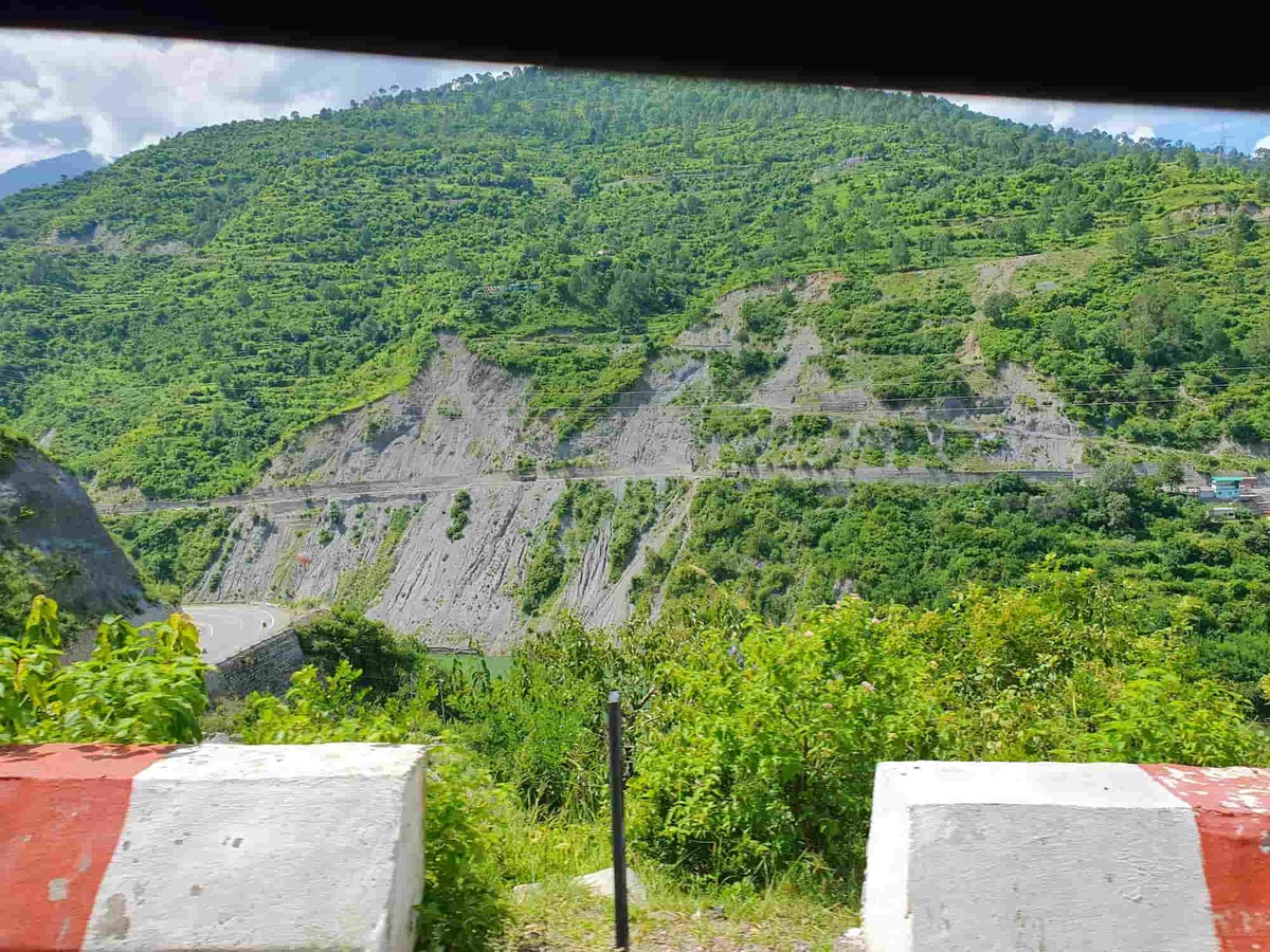
An updated and complete landslide inventory is the starting point for an appropriate hazard assessment, and for analysing long-term correlation with extreme weather events and increasing infrastructure activities. Multitemporal landslide inventories, covering decades, are needed but are widely unavailable for high-mountain regions globally. Dense geotechnical sampling-based analyses from active and stabilised landslides are planned in this project to help characterise particle size, clay and moisture content, mineral composition, crystallographic structures, and the influence of geomorphic processes on the landslide occurrences.
Within social science domain, there is no operational project that directly links long-term physical science assessments of landslide hazards with the community perception of hazards. This is the reason why implementing hazard mitigation strategies has been particularly challenging as there has been a knowledge gap on designing community-based and socially acceptable guidelines on hazard mitigation.
This project targets the requirements highlighted by the Geological Survey of India, the nodal agency of landslide studies, after the 2013 Uttarakhand disaster. Thus, the anticipated outcomes will be directly beneficial to high-mountain communities in delivering improved knowledge on landslide events, and taking a step towards mitigation through preparedness and increased awareness amongst all the stakeholders. Extreme weather events and resulting mass movements are bound to increase in the region as the regional climate change has been depicted as one of the most dramatic globally. The project results will help inform the policy makers on the highly landslide hazard-prone regions, to ensure sustainable CI development.
The project benefits from a diverse panel of experts, integrating an interdisciplinary approach that enhances its depth and impact. Specialists from remote sensing, geosciences, climate science, disaster management, and social sciences contribute their expertise, ensuring a comprehensive understanding of landslide dynamics and their broader implications.
This collaborative framework allows for a multifaceted analysis, combining advanced satellite-based mapping, field investigations, numerical modelling, and socio-economic assessments. The inclusion of social science experts provides valuable insights into the human dimensions of landslides, including their impact on local communities, resilience strategies, and policy implications. By bridging scientific research with societal perspectives, the project aims to develop more effective risk assessment methods, mitigation strategies, and disaster response frameworks tailored to the needs of affected populations.
School of Geosciences,
University of Aberdeen, UK
Birbal Sahini Institute of Palaeosciences, India
School of Geosciences,
University of Aberdeen, UK
School of Geosciences,
University of Aberdeen, UK
School of Geosciences,
University of Aberdeen, UK
School of Geosciences,
University of Aberdeen, UK
Department of Anthropology,
University of Aberdeen, UK
Birbal Sahini Institute of Palaeosciences, India

School of Social Sciences,
Jawaharlal Nehru University, India
Govind Ballabh Pant National Institute of Himalayan Environment, India
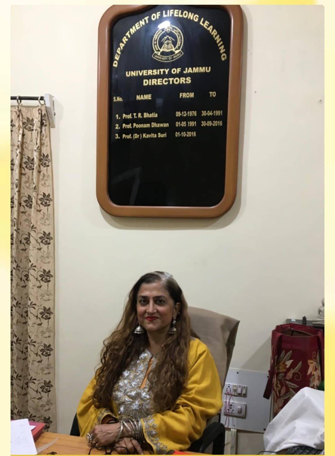
Department of Lifelong Learning,
Jammu University, India
Borehole Geophysics Research Laboratory,
Ministry of Earth Sciences, India
School of Geosciences,
University of Aberdeen, UK
As part of the first field visit in September 2024, a comprehensive field reconnaissance of active and past landslides in the region was carried out, providing valuable insights into their occurrence and impact. This groundwork serves as a foundation for further analysis and monitoring efforts. The geocoded photographs were particularly helpful in validating multi-resolution landslide inventory for 2024.
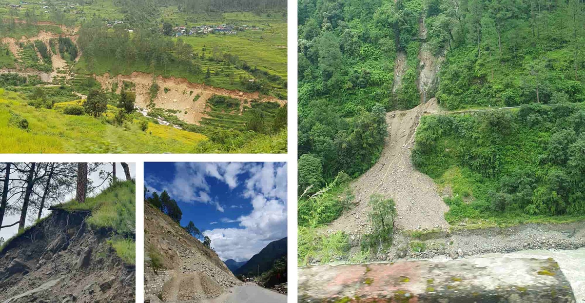
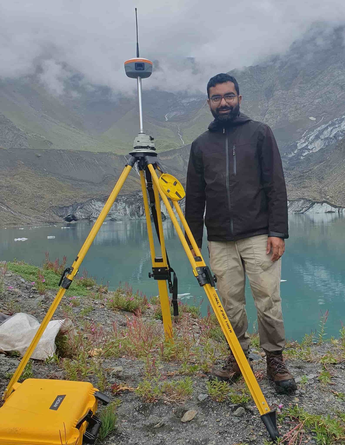
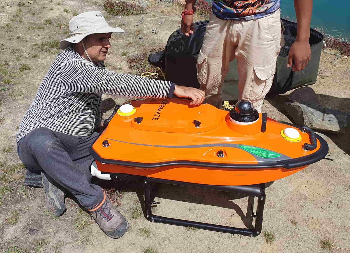
During spring and summer of 2025, an extensive survey of the study region will be conducted with a more rigorous approach. This survey aims to systematically map landslides using high-resolution satellite datasets and integrate field observations for validation. Ground truth data collected during the field survey will be crucial in assessing the accuracy of satellite-derived landslide maps, refining mapping techniques, and improving the overall understanding of landslide dynamics in the region. This integrated approach will enhance the reliability of landslide detection and contribute to the development of more effective monitoring and mitigation strategies. Moreover, extensive geotechnical sampling of the key landslide zones is planned for further geochemical analysis to establish the linkage between lithology and landslide frequency with respect to extreme precipitation events. Hazard perception of local communities will be recorded through social surveys and interactions, furthering the impact of this work.
Our team achieved notable research milestones in 2025. We published four peer-reviewed articles in leading scientific journals, including Nature communication earth & environment, Nature Natural Hazards, and Physics and Chemistry of the Earth, Parts A/B/C. These studies focused on Ice-rock avalanches and Glacial Lake Outburst Floods (GLOFs) a rapidly growing hazard that poses severe risks to human lives and significantly impacts the socio-economic fabric of High Mountain regions.
We also presented our research on the pre-collapse dynamics of a hanging glacier at the European Geosciences Union (EGU) General Assembly 2025. In addition, our research on landslide modelling and GLOF risk was presented as a poster at the British Society for Geomorphology (BSG) Annual Conference 2025, held at the University of Leeds, UK.
https://www.nature.com/articles/s43247-026-03352-y#Ack1
https://www.nature.com/articles/s44304-025-00097-0#Ack1
https://www.sciencedirect.com/science/article/pii/S1474706525000580#sec7
https://www.nature.com/articles/s44304-025-00097-0
https://meetingorganizer.copernicus.org/EGU25/EGU25-17719.html
The project has received substantial media attention in both the UK and India, with various print and electronic media outlets recognizing its significance in advancing the understanding of landslides in the Himalayas. Several media agencies from both countries have conducted interviews with our experts to discuss the impact of landslides and other natural hazards in the region. These interactions have helped raise awareness about the growing risks posed by landslides, their underlying causes, and the need for effective monitoring and mitigation strategies. The media coverage has also highlighted the scientific approaches being used in the study, including satellite-based mapping and field investigations, further emphasizing the project's contribution to disaster risk reduction and environmental sustainability.
Additionally, through talks and conferences, efforts have been made to raise awareness about the project's outcomes, engage a wider audience, and foster potential collaborations. These collaborations aim to enhance the project and introduce new dimensions to its scope.
The UK Research and Innovation (UKRI) is the UK's leading public funder of environmental science, supporting research on Earth, atmospheric, marine, and polar sciences.
The Ministry of Earth Sciences (MoES), India funds research projects in atmospheric, oceanic, and earth sciences to support scientific advancements and policy-making.