The Environmental Modelling Group at the University of Aberdeen develops models to understand and predict the interactions between land use, ecosystems, and the climate system. Our research spans local, national, and global scales, supporting evidence-based policy on sustainable land management, carbon sequestration, and greenhouse gas mitigation. EMG scientists work across multiple disciplines, linking ecology, soil science, energy systems, and socio-economic analysis, to quantify environmental change and assess solutions for moving towards net zero and beyond.
Current projects address some of the most urgent environmental challenges of our time. These include advancing understanding of carbon dioxide removal (CDR) through the UPTAKE project, funded by Horizon Europe; improving estimates of soil hydrogen uptake in the ELGAR study within the UK’s Hydrogen Environmental Impacts Programme; and refining models of methane emissions from tropical peatlands through NERC-funded fieldwork and simulation in Peru and Central Africa. Alongside these, EMG contributes to long-standing initiatives on bioenergy, afforestation, and land-use transitions, such as MiscanFor, GIANT-LINK, GRACE, GGR+, and PBC4GGR.
Together, these projects form a comprehensive research portfolio aimed at improving our ability to measure, model, and manage the environmental consequences of human activity. By combining robust data with innovative modelling tools like RothC and ECOSSE, the group provides actionable insights for governments, industry, and international climate bodies, helping to shape a sustainable and resilient future.
Land Use, Carbon & Greenhouse Gas Modelling
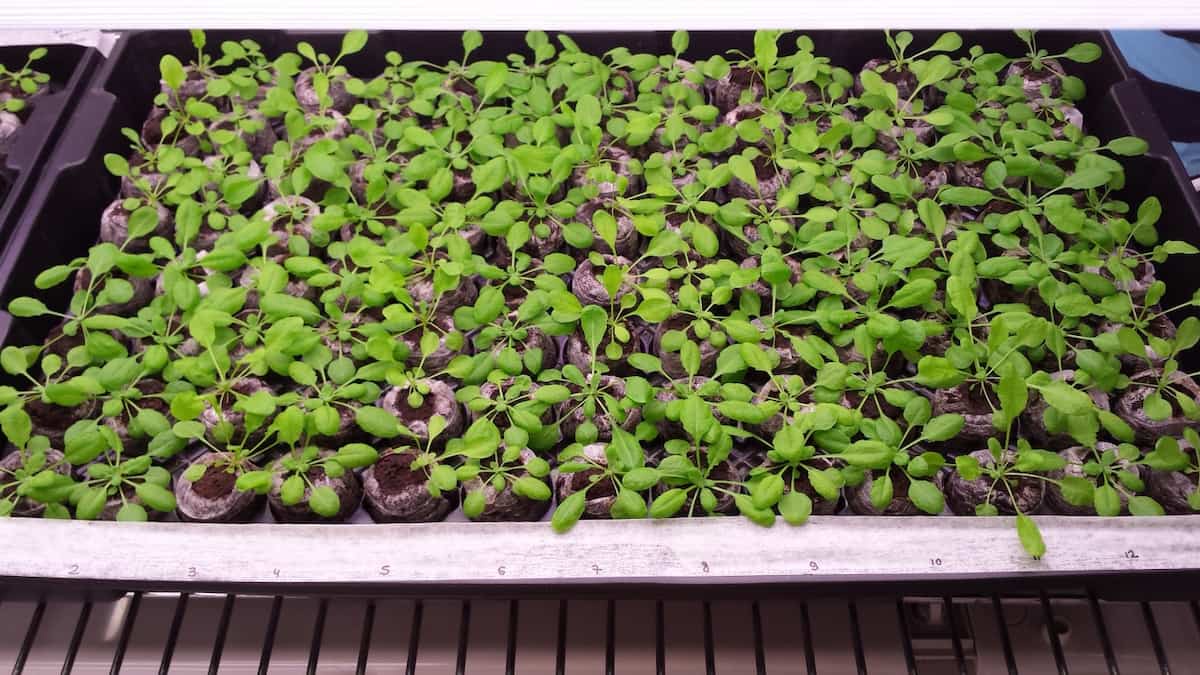
- Genome-wide association mapping and landscape scale modelling of heritable ionomic diversity in Arabidopsis thaliana populations
-
People
- William van Dijk
- Ana Carolina Atala Lombelo Campos
- Alex Douglas
- David Salt
- Pete Smith
This project combines geographic information systems and genetic approaches to identify the genes that control the way plants take up mineral nutrients found in fertilizers such as potassium and phosphorus and potential toxic substances such as sodium (for the plant), and arsenic and cadmium (for humans that eat the plants). By understanding how different forms of the genes we discover are used by plants to allow them to grow in soils containing different levels of mineral nutrients or potentially toxic elements we can understand the role these genes play in allowing plants to adapt to the varied soil conditions they are exposed to in their natural habitats. A better understanding of these adaptations in natural populations of plants would have significant practical benefits for agriculture by providing the information needed for the development of new varieties of crops better able to provide the increased yields needed to meet the future demand for more cereals for biofuels, more grain for meat, and more food for the additional 2 billion people expected by 2050.
The approach will combine genome-wide association mapping (validated by linkage mapping and molecular genetics) with landscape scale modelling. It utilizes the large pool of genetic diversity in natural populations of A. thaliana to identify genes, alleles and mechanisms of value in adaptation to the varied edaphic conditions A. thaliana populations encounter across the landscape. Once characterized this natural diversity offers potentially new approaches to manipulate such agriculturally important traits as salinity tolerance and mineral nutrient efficiency to develop crop varieties that are more resilient to the predicted impacts of climate change on soil fertility, and to improve yields in a more sustainable manner to deliver the yield gains required to meet future population growth.
- MACSUR
-
People
The project FACCE MACSUR is organised as a Knowledge-Hub and has the aim to link agricultural modelling approaches with political aspects and agricultural trade.
The objective is to determine the impact of climate change on the food production in Europe. As part of the project scaling and the impact of data aggregation on simulation results is one emphasis.
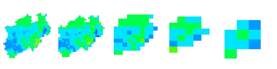
For a study area (about 34000 km2) input data are aggregated for 5 different scales (1km2, 10 km2, 25km2, 50km2 and 100 km2 grid cells) and ecosystem relevant variables are simulated by 13 different models (crop and biogeochemical models). More details are on the web page http://www.scale-it.net/ .
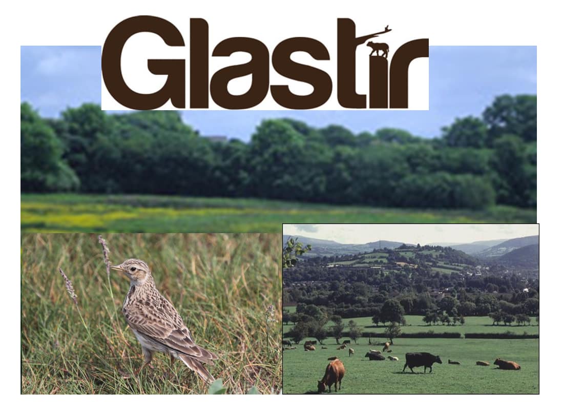
- Glastir
-
People
- Dr Mohamed Abdalla
- Dr Mark Richards
- Prof Pete Smith
Website
The Welsh Government is committed to reducing greenhouse gas (GHG) emissions from agriculture, protecting the environment and combating the effects of future climate change. To achieve these objectives, the Glastir programme is in force, in which farmers are financially supported to adopt a range of on-farm measures to protect soil C, reduce GHG emissions, improve water quality and enhance biodiversity. As part of this project we are simulating GHG and soil organic carbon (SOC) fluxes for Wales using ECOSSE-model.
The main aims of the ECOSSE simulations were: 1) to estimate average annual GHG and SOC fluxes for Wales; 2) to investigate the effects of the reduced N fertilizer application Glastir measure on GHG fluxes; and 3) to investigate the impacts of future climate change on the fluxes of GHG and SOC and plant net primary productivity (NPP).
- GREENHOUSE
-
People
- Mark Richards
- Pete Smith
Website
GREENHOUSE uses extensive existing UK field data and targeted new measurements to build accurate greenhouse gases (GHG) inventories and improve the capabilities of two land surface models (JULES and CTESSEL) to estimate GHG emissions.
Sinks and sources of GHGs vary in space and time across the UK because of the landscape's mosaic of managed and semi-natural ecosystems, and the varying temporal sensitivities of each GHG's emissions to meteorology and management.
Understanding spatio-temporal patterns of biogenic GHG emissions will lead to improvements in flux estimates, allow creation of inventories with greater sensitivity to management and climate, and advance the modelling of feedbacks between climate, land use and GHG emissions.
GREENHOUSE is a collaborative effort involving 20 organisations. Our role within this consortium is to build CH4 and N2O emissions emulators of three established soil models: ECOSSE, Landscape DNDC and DailyDayCent. The model emulators will be embedded in the CTESSEL land surface model to enable it to simulate soil CH4 and N2O emissions.
- Agricultural Greenhouse Gas Inventory Research Platform
-
People
- Nuala Fitton
- Arindam Datta
- Pete Smith
Website
This project seeks to improve the accuracy and resolution of our reporting system by providing new experimental evidence on the factors affecting emissions and statistics relevant to changing farming practices in the UK. It will provide the evidence for a UK specific method of calculating methane and nitrous oxide emissions that will reflect the adoption of mitigation practices by the industry, enabling the forecasting and monitoring of performance against target emissions reductions set by the UK Climate Change Act. This will build upon previous research, combining field experimentation, modelling and scoping of data sources to fill knowledge gaps.
The overall platform is divided into three separate work packages, the work packages we are directly involved in include:
AC0114 - Data synthesis, modelling and management
This aims to provide a synthesis of existing and new evidence on GHG emission factors and the effectiveness of mitigating measure. This will involve use of computer models linked to survey data to develop improved methodologies that will represent the spatial pattern of agricultural activities and inputs across the UK in relation to climate and soil types.
AC0116 - Measurement of nitrous oxide emissions from soils
Key soils and climate zones and sources of the N2O that have been identified as requiring further measurements to generate country specific emission factors were identified within this project. Then based on a clear set of protocols that cover experimental design, data handling and other aspects, N2O measurements will be collated over an year. Measurements made as part of this project will then be used to calibrate mechanistic models such as DailyDayCent and Landscape DNDC. From this we will then generate spatial emissions of N2O based on the most recent survey data and in addition test the potentiality of some mitigation strategies for both grass and cropland across the UK.

- ClimateXchange
-

- Nuala Fitton
- Ed Jones
- Pete Smith
Website
ClimateXChange's aim is to provide independent advice, research and analysis to support the Scottish Government as it develops and implements policies on adapting to the changing climate and the transition to a low carbon society.
CXC's ongoing woodlands project builds on existing work in the RESAS Strategic Research Programme (SRP), specifically the work on soil carbon and woodland expansion for multiple benefits, by focusing on the implications of different woodland planting scenarios in different areas of Scotland for net Global Warming Potential. As part of this collaborative project we aim to simulate the effect of land use change to forestry on soil C stocks across Scotland. To do this land cover and soils data will be combined with different tree species suitability, yield and productivity and their effect on soil C will be simulated until 2050 under both current climate conditions and future climate change (as outlined in UKCP09).
- Carbon sequestration in highly organic soils impacted by fire
-
People
- Marvin Beckert
The carbon sequestration potential of soils depends on the turnover time of the organic carbon inputs. Carbon turnover models partition soil carbon into distinct pools with different turnover times. Soil carbon fractionation methods can relate those model pools to measurable soil fractions. Approaches have been developed that successfully relate mineral soil fractions to model pools, but those approaches fail for highly organic soils.
Carbon stabilisation is mostly achieved by physical protection in mineral soils, whereas organic soil stabilisation depends on environmental conditions and chemical recalcitrance. Based on existing approaches, a fractionation scheme that can potentially expand fractionation to organic soils is developed. The approach combines a widely tested mineral soil fractionation scheme with a chemical fractionation method to capture the full range of stabilisation mechanisms in mineral, organo-mineral and organic soils.
The fractions, ranging from labile to highly recalcitrant, are tested against modelled pools of the RothC/ECOSSE soil carbon turnover model. The approach is tested on mineral and peaty soil samples in Scotland and Tasmanian moorland peat samples to capture the processes of a wide range of peat forming materials and climates.
Both the Scottish and the Tasmanian ecosystems are subjected to regular burning and the influence of those burning regimes of the formation of labile and stabilized carbon pools will also be investigated. These data can help to estimate the long term carbon storage capabilities of those locally and globally important ecosystems.
- Forest conversion to rubber and oil palm plantations
-
People
- Fitri Aini
This work is measuring greenhouse gas fluxes in mineral soils where indigenous forest has been converted to oil palm and rubber plantation and measuring the effect of land use change on greenhouse gas emissions.
To measure the impact of this land use change, we assessed the impact of forest change to rubber and oil palm plantations on nitrous oxide (N2O), methane (CH4) and carbon dioxide (CO2) emissions in Pasir Mayang, Jambi, Sumatra.
We conducted measurements over fourteen months in a forest, disturbed forest, one year rubber plantation, twenty years rubber plantation and eight years oil palm plantation. Intensive daily measurements were taken following fertilizer application in the oil palm plantation.
All of the plantations are managed by smallholder farmers and have never been fertilised. To assess the effect of common farmer management practices, we add nitrogen fertilizer (urea) at a rate of 33.3 kg N ha-1.
There was no seasonal variability measured in this area for CH4 and CO2 fluxes. Termite activity is measured to explain the trends in CH4 fluxes as there is evidence that termites have a significant impact on CH4 emissions.
- Modelling current and future greenhouse gas balances from forest soils in the UK
-
This project will simulate soil carbon change and greenhouse gas emissions from UK forests, under current and future conditions. The project will couple a model of organic matter turnover and greenhouse gas emissions from soils, with models describing the greenhouse gas balance in forest vegetation.
The soil model used will be ECOSSE (Smith et al., 2010). The forest vegetation models will be the ESC (Pyatt et al., 2001), Carbine (Thompson and Matthews, 1989; Matthews, 1996) and CSORT (Morison et al., 2012) family of models.
The simulations will be evaluated against the extensive forest soil datasets available at Forest Research, including the 220 Biosoil network sites (Vanguelova et al., 2013).
Additional sites will be included where pair wise plot comparisons allow sequential model calibration and evaluation; this will provide the opportunity for a more detail analysis of model performance.
The model will be used to simulate greenhouse gas balances and changes in soils in forests across the UK under different scenarios of land use and climate change.
This information will be valuable to both policy makers and the Forestry Commission for quantifying the greenhouse gas mitigation potential of current and future forestry planting schemes.
- The influence of termites on the supply of ecosystem services from dryland ecosystems
-
Termites are considered ecosystem engineers, and in some cases keystone species in tropical and subtropical regions, and aside from being well documented pests of crops and timber, play major roles in ecosystem functioning via their various effects on soils. Their roles as agents of decomposition and in nutrient cycling, soil processing and formation is particularly important in dryland areas where fungal and bacterial influence on soils tends to be less significant.
This project will seek to characterise the diversity of the termite community in areas of land across a soil restoration gradient, using the Alaba watershed in southern Ethiopia as a case study.Soil erosion and loss of agriculturally productive land is a major concern in Ethiopia, including the study area, where exclosure zones have been established of differing ages in the hope of mitigating the effects of soil degradation, and restoring soils back to productive use.
The spatial influence of distinct functional groups of termites on key ecological properties relating to soil carbon, water and nutrients in the landscape will be characterised across a soil restoration gradient, by mapping their mounds at the landscape level in different land use zones across the study area.
Field sampling and laboratory analyses of soils and termites will be employed to obtain detailed information on ecological properties using standard environmental methods (such as soil Carbon, Nitrogen, texture and moisture in the field) as well as isotopic analysis back in laboratories at the James Hutton Institute.
Management changes associated with increasing soil carbon will also be investigated for their potential effect on termite diversity and, by extension, implications for ecosystem functioning.
- Mapping risk to ecosystem services from organic soil degradation and evaluation of impacts of wetland ecosystem services investments
-
This project will investigate
i) techniques for mapping ecosystem services and ecosystem service beneficiaries,
ii) how investments in wetland ecosystem can be made to maximise multiple objectives and mitigate trade-offs among stakeholders.
Research will develop a better understanding of the supply of ecosystem services from wetland organic soils; how wetland ecosystem services are generated and distributed within the landscape, and how ecosystem service benefits are appropriated and by whom.
This understanding will be used to analyse trade-offs from wetland investments under different wetland management scenarios.
This will build an analysis framework to guide targeted investments for sustainable wetland management in Uganda for mitigating greenhouse gas emissions and alleviation of poverty.
This project is in collaboration with the James Hutton Institute, Aberdeen.
- Environmental and Ecological Drivers of Tropical Peatland Methane Dynamics Across Spatial Scales
-
People:
- Jo Smith
- Saeed Karbin
Timeline:
- 2025-2026
Description:
This NERC-funded project investigates the environmental and ecological factors driving methane (CH₄) emissions from tropical peatlands—critical carbon stores and significant contributors to rising atmospheric methane levels.
The project reduces uncertainties in CH₄ flux estimates by integrating long-term field measurements with advanced modelling. Fieldwork takes place in the Pastaza-Marañón Foreland Basin in Peru, where researchers measure CH₄ fluxes alongside ecosystem productivity, peat properties, and nutrient dynamics across peatlands with varying vegetation types and nutrient availability.
The project aims to model CH₄ emissions at the field scale and upscale these estimates to the regional level. It develops a simple, scalable model that operates effectively with limited data inputs, making it suitable for broader application in data-scarce regions.
To achieve this, the team links CH₄ production to biological activity, which is simulated using the ECOSSE model. Methane production is also correlated with CO₂ levels, providing a practical method for estimating CH₄ fluxes. The model incorporates newly collected data from Central African peatlands—an ecologically similar but understudied region—and applies the refined model to upscale CH₄ flux estimates across South American peatlands. This approach also tests hypotheses about the drivers of increasing CH₄ emissions, including changes in hydrology, vegetation inputs, and climate warming.
Collaborating Institutions:
- University of Nottingham
- Cranfield University
- The Enigma of soil hydrogen sink controls and variations (ELGAR)
-
People:
- Jo Smith
- Saeed Karbin
Timeline:
- 2023-2025
Description:
ELGAR is one of three interconnected research projects within the Hydrogen Environmental Impacts Programme, funded by UKRI/NERC and the Department for Energy Security and Net Zero (DESNZ). Running from 2023 to 2025, the programme explores the environmental implications of a hydrogen-based energy future, focusing on emissions, atmospheric chemistry, and soil interactions.
Hydrogen (H₂) is a secondary greenhouse gas that indirectly extends the atmospheric lifetime of methane by competing for hydroxyl radicals. Soils serve as a major sink for atmospheric hydrogen, making it critical to understand and predict hydrogen uptake at regional and global scales.
ELGAR aims to improve the modelling of soil hydrogen sinks by integrating laboratory experiments and field observations. Unlike previous models that emphasized abiotic factors, ELGAR introduces a novel microbial activity rate modifier, highlighting the role of soil organic carbon (SOC) in regulating microbial hydrogen uptake.
The project uses the RothC model to simulate microbial activity based on climate data and soil properties such as texture, pH, electrical conductivity (EC), and SOC. This approach accounts for both current and historical climate influences and enhances estimates of hydrogen deposition velocity across diverse datasets.
Collaborating Institutions:
- UK Centre for Ecology & Hydrology
- University of East Anglia
- University of Bristol
ELGAR works alongside two sister projects—HECTER and COSH-AIR—to provide a comprehensive understanding of hydrogen’s environmental footprint.
Bioenergy & Low Carbon Transitions
- PBC4GGR
-
The Perennial Biomass Crops For Greenhouse Gas Project – a BBSRC CO2 Reduction Demonstrator project
PBC4GGR is a perennial biomass crop project to determine the flow of carbon from atmosphere to crop and to the soil. Aberdeen’s part is to model the flow of carbon at our field sites of commercial scale miscanthus at Bishop Burton, East Yorkshire and commercial scale src willow at Myercough, Lancashire. Here’s a publication from the project on a global database of short rotation coppice willow regarding genotype, environment and yield - https://onlinelibrary.wiley.com/doi/full/10.1111/gcbb.70069
University of Aberdeen staff:
Prof Astley Hastings, Dr Anita Shepherd, Antonio Castellano Albors
Will Macalpine and Ian Shield (Rothamsted)
Judith Thornton and Chris Ashman (IBERS)
Janette Whitaker and Caio Fernandes Zani (CEH)
- UPTAKE
-
University of Aberdeen Contributors:

- Dr. Mohamed Abdalla
Description:
UPTAKE aims to support responsible, inclusive, and effective development and deployment of Carbon Dioxide Removal (CDR) methods to meet EU climate neutrality targets. It addresses scientific, technical, socio-economic, governance, and ethical aspects of CDR implementation.
Key Goals
- Develop integrated assessment frameworks for evaluating CDR options across scales.
- Co-design implementation pathways with stakeholders from local to national levels.
- Advance understanding of the potentials, risks, and trade-offs of land-based, ocean-based, and technological CDR.
- Incorporate social justice, equity, and gender perspectives into CDR assessments.
- Provide robust evidence for EU policy and global climate negotiations.
Relevance
UPTAKE is critical for shaping a science-based, ethically sound, and socially acceptable CDR strategy within the EU Green Deal framework and the Paris Agreement commitments.
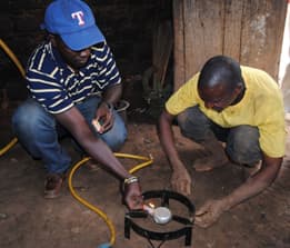
- Afri-Flame
-
People
- Jo Smith
- Nick Morley
- Norval Strachan
- Vianney Tumwesige
Website
The Afri-Flame project (Adaptation of small-scale biogas digesters for use in rural households in Sub-Saharan Africa) aims to investigate suitability of different designs of biogas digester to different environmental and socio-economic conditions of Sub-Saharan Africa.
Biogas technology is an integrated waste management system that is a clean, renewable, naturally produced and under-utilised source of energy. Methane is produced by anaerobic digestion of organic wastes. The gas produced is similar to natural gas and is composed of 50-70% methane, the remainder being composed of carbon dioxide and traces of hydrogen sulfide and ammonia.
It can be used for heating, cooking, electricity production, and vehicle fuel, and can be piped, bottled, stored, compressed, and even liquefied, providing on-site energy production, storage and access. Furthermore, the residue from the digestion process, “bioslurry”, is a valuable organic fertiliser that is rich in available nitrogen, and treating organic wastes to provide biogas can reduce the spread of pathogens in the local environment.
There is a significant move within many countries of Sub-Saharan Africa to increase the implementation of zero grazing systems. This provides a timely incentive for biogas development in order to fully utilise the increased animal wastes available at the household level. The number of biogas installations across Africa is increasing, largely in the domestic energy sector, due to national domestic biogas programmes. However, technical, environmental, financial and social questions remain, and the rapid increase in the proposed number of installations means that providing scientifically rigorous answers to these questions is of urgent importance.
This project aims to provide these answers through detailed measurements of the flows of carbon, nutrients, water, energy and finances associated with biogas installations, assessment of changes in indoor air quality and spread of pathogens and by a thorough socio-economic analysis of the factors restricting uptake.
The questions to be addressed are:
- What are the barriers to uptake of biogas digesters in Sub-Saharan Africa?
- What inefficiencies in the use of resources are associated with biogas digesters in Sub-Saharan Africa?
- How can existing technologies be adapted to be more suitable for local conditions?
- Production of a toolkit to support promotion, selection, installation and long term maintenance of biogas digesters in Sub-Saharan Africa.
- (University of Aberdeen, James Hutton Institute, Climate Futures),
- Uganda (Makerere University, Green Heat Ltd),
- Ethiopia (Addis Ababa University, Institute of Sustainable Development), and
- Cameroon (Catholic University Cameroon, Phyto-biotechnology Research Foundation).
From the University of Aberdeen it involves Jo Smith, Nick Morley, Norval Strachan and Vianney Tumwesige.
Image: Vianney Tumwesige testing a biogas installation in a household in Uganda
- ELUM
-
- Marta Dondini
- Mark Richards
- Astley Hastings
- Pete Smith
Website
The ELUM project is commissioned by ETI (Energy Technologies Institute) to provide greater understanding on the GHG and soil carbon changes arising as a result of direct land-use change to bioenergy crops, with a primary focus on the second-generation bioenergy crops Miscanthus, short rotation coppice-willow and short rotation forestry (SRF). The project is UK-bound, but with many outcomes which could be internationally relevant.
The aim of the project was to develop a user-friendly modelling tool from which the impacts of bioenergy land-use change on soil carbon and field GHG balance could be explored spatially across the UK. The modelling tool outputs were derived from the well-established ECOSSE soil carbon and GHG model. An essential aspect of developing this model was the availability of data for model parameterisation and validation.
- MAGLUE
-
People
The MAGLUE project is aimed at quantifying the real GHG balance of different land use transitions to bioenergy crops, for both UK and imported bioenergy feedstocks.
We deploy sophisticated state-of-the-art instrumentation that is able to measure GHGs very rapidly, to gain a better insight into the dynamic range of GHG emissions that can occur in such systems.
Following data collection, we will extend our analysis by modelling a wide geographical range across the UK and for biomass feedstock sourced from other areas of the world to identify the best bioenergy chains, in terms of GHG balance, and to determine how much imported feedstock might be sustainable in the future.
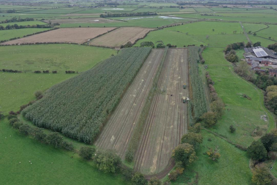
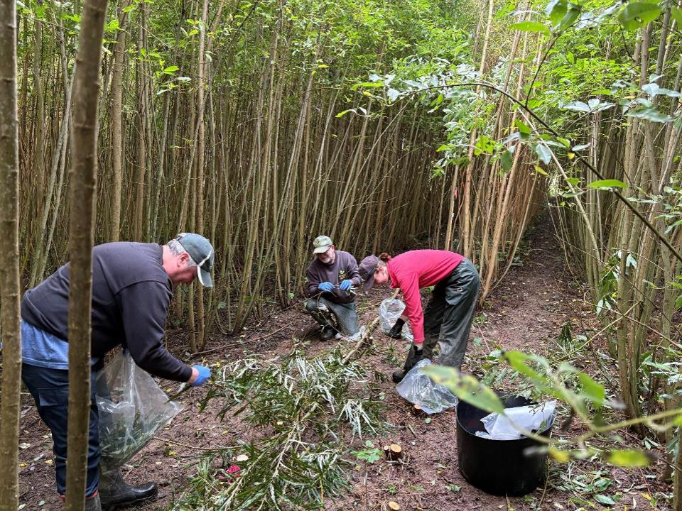
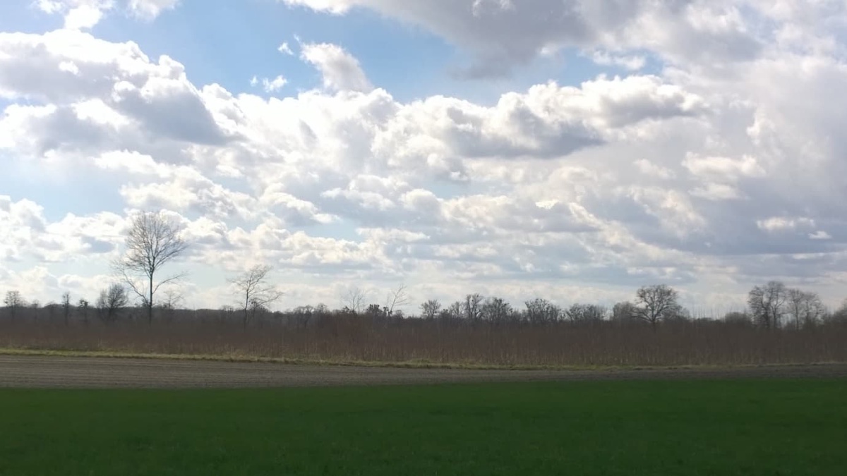
- GIANT-LINK
-
People
- John Clifton-Brown & IBERS team
- Astley Hastings
The development of Bioenergy is fuelled by the vision that C emissions will be reduced by substituting fossil fuels with appropriate energy crops and that this will both make a significant contribution to future energy security by reducing fossil fuel dependence and provide new options for farmers, especially in marginal lands. Miscanthus, a ubiquitous Asian C4 grass with high yields and low inputs is one of the most promising plant species for bioenergy development.
This is achieved by a Miscanthus breeding programme to produce new genotypes for commercialization that integrates the breeding programmes funded at IBERS by DEFRA (2004-2010) and CERES (2007-2010), and linking to a suite of co-ordinated BBSRC funded research projects underpinning breeding science and collecting new germ plasm from Asia.

Germplasm Collection --> Characterisation --> Crossing --> Plot Trials --> Variety testing
Work Package 1
Develop, calibrate and use a crop model to inform the use of genetic resources that will deliver genotypes able to perform well under various UK conditions, and cope with climate change (IBERS, Aberdeen)Work Package 2
Develop Miscanthus germplasm that will reduce net greenhouse gas emissions even further and be carbon negative (IBERS, CERES).Work Package 3
Test potential new Miscanthus hybrids in conjunction with supply chain participants and the evaluation of potential varieties from 2.3 (IBERS, E-ON, British Chlorophyll, NFU, CERES).Work Package 4
Develop agronomic methods to reduce the costs of biomass production from Miscanthus including the development of cheaper propagation methods. - Modelling Ecosystem Service Impacts of Bioenergy Production in Europe
-
People
This project involves modelling the impact of bioenergy production in Europe on ecosystem services.
The distribution and production of second generation energy crops, such as Miscanthus, Short Rotation Coppice (SRC; willow, poplar and other broadleaves) and Short Rotation Forestry (SRF), including differences in species used in European countries, are being investigated. Potential impact will be modelled for the time between 2015 and 2050, every 5th year.
Both GHG and ecosystem models (ECOSSE, DayCent) will be used to examine the impacts of these crops on ecosystem services, such as carbon storage, greenhouse gas emissions, biodiversity and soil, water and air quality.
The project will build on models of energy crop production (MISCANFOR, SALIXFOR), soil impacts, yield, greenhouse gas emissions and other ecosystem services, and work undertaken in the UK on the ETI-funded ELUM project.
Further, ecosystem valuation tools (e.g. ecosystem service approach, TEEB) and models will be involved and research regarding optimisation of land use change feedbacks on ecosystem services and biodiversity as well as weighting of the importance of the individual ecosystem services will be done.
The focus will be on two areas, the strictly quantitative and the more qualitative ecosystem services. Some areas are not easily allocated to either category and will have to be assessed in a different way, e.g. using a framework or threat matrix system.
- LUNA (Land Use Net-Zero Advisor)
-
Institutions and People Involved:
- University of Aberdeen
- Rebecca von Hellfeld
- Jon Reid
- Arkan Eddine-Lomas
- Astley Hastings
- Lancaster University
- Alona Armstrong
- Fabio Carvalho G Da Silva
- Duncan Whyatt
- Forest Research
- Carly Whittaker
- Emma Hubbert
- Kate Beauchamp
- Héloïse Robinson
- Geoff Hogan
- Gaia Marini
- Robert Matthews
Project Related Links
Please cite me: A. Eddine-Lomas, J. Reid, R. von Hellfeld, D. Whyatt, C. Whittaker, E. Hubbert, A. Armstrong, F. Carvalho Da Silva, A. Hastings (2025) LUNA (v.1.2)
Project Description
The Land Use Net-Zero Advisor (LUNA) is a software tool developed as part of a bigger project comparing carbon budgets of different land use change options in Great Britain including forestry, solar farms, wind farms, and bioenergy crops.
LUNA is a user-friendly communication tool that enables users to understand the carbon impact and energy generation potential of different land use changes spatially. LUNA also allows for rapid comparison of these different transitions across Great Britain.
LUNA's results are based on a range of models including WindFor, SolarFor, MiscanFor, ESC, CARBINE, and COHORT.
The project was funded by DEFRA under the Nature for Climate Fund (NCF). Project Reference: ETPP-33 (C10) Comparing carbon budgets for different land use options, March 2025.
- University of Aberdeen
Sustainable Agriculture & Food Systems
- The Sustainable and Healthy Food Systems - Southern Africa (SHEFS-SA)
-
This project, funded by the Wellcome Trust and led by the University of KwaZulu-Natal, South Africa, with collaborators in the UK, Zimbabwe and Malawi aims to enhance understanding of complex climate change challenges for health, in relation to food systems in order to develop appropriate regional policies within the Community of Practice. Health is inclusive of the physical and Mental health of humans, as well as the health of livestock, fisheries ecosystems and soils.
Dr. Jennifer Wardle, from University of Aberdeen, has the role in this project of investigating the potential of biochar soil amendment as an affordable and achievable means for smallholder farmers in Southern Africa to improve the uality of their soil through enhanced carbon, nutrient and water retention.
- The ALTER Project
-
People
- Jo Smith
- Jenny Farmer
- Charlie Langan
- Sam Gandy
Website
ALTER (Alternative Carbon Investments in Ecosystems for Poverty Alleviation) is a 3 year international research initiative involving collaboration with partners from the UK (James Hutton Insitute, University of Aberdeen), Ethiopia (Hawassa University, the Southern Agricultural Research Institute and the International Water Management Institute) and Uganda (the Carbon Foundation of East Africa). ALTER aims to demonstrate how improved knowledge about soil degradation can be used to address poverty issues. Solutions to soil degradation are not simple and require a much better understanding of how people benefit from soils, what they stand to gain if they can improve the condition of the soils that they manage, what they would need to do to accomplish this and what barriers may prevent this. ALTER also aims to gain better insight into the likely success of different management options and investment strategies to improve soils, and the goods and services that they supply.
Our role in the project is to understand the ecosystem services available from the soil. We are working in dry mineral soils in Halaba (Ethiopia), and highly organic wetland soils in Uganda. Soil models that can function at both plot and landscape scale are being used to bring together mechanistic understanding from the plot, and scale up to the landscape and give predictions both within the year and extended over 100 years to investigate sustainability. Different management options to improve degraded soils are being investigated by a combination of modelling and experimental work.
The work involves Jo Smith (assessing the capacity of soil capital to supply ecosystem services across scales), Jenny Farmer (measuring and modelling changes in soils and greenhouse gas emissions in wetlands of Uganda), Charlie Langan (predicting ecosystem service loss and targeting management interventions), and Sam Gandy (investigating the influence of termites on the supply of ecosystem services from dryland ecosystems).
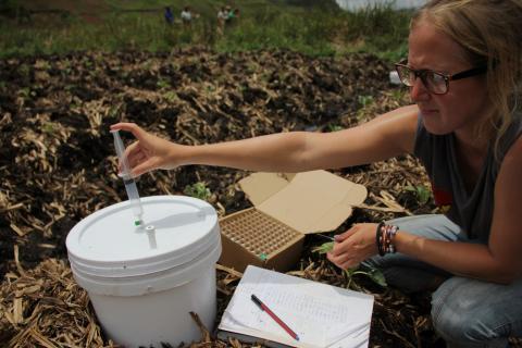
Image: Jenny Farmer taking gas samples in Ugandan wetlands that have been drained and are being used to grow potato
- FACESMAP
-
People
Website
The objectives of FACESMAP are:
- To analyse attitudes and constraints of different forest owner types in Europe and the ongoing changes (outputs: literature survey, meta-analyses and maps).
- To explore innovative management approaches for new forest owner types (outputs: case studies, critical assessment).
- To study effective policy instruments with a comparative analysis approach (outputs: literature survey, case studies, policy analyses).
- To draw conclusions and recommendations for forest-related policies, forest management practice, further education and future research.
These objectives will be addressed by themes organized around three working groups (WGs).
- To analyse attitudes and constraints of different forest owner types in Europe and the ongoing changes (outputs: literature survey, meta-analyses and maps).
- The Cool Farm Tool
-
People
- Jon Hillier
- Matthias Kuhnert
Website
The Cool Farm Tool is an online greenhouse gas calculator which is now helping the farming industry to measure, understand and act on its carbon footprint. Originally developed by Jon Hillier and colleagues in our group, in partnership with Unilever and the Sustainable Food Lab, the tool is now owned by the not-for-profit Cool Farm Alliance. The Alliance's diverse membership is composed of businesses from the food and drink sector, retailers, fertiliser companies, consultancies, as well as NGOs and academic organisations.
The Tool currently uses global empirical models of GHG emissions from agricultural practices (but modified by site or climatic conditions) and is design to make it easy for farmers to test alternative management scenarios.
The Cool Farm Tool won the 'Practice with Science' Award run by the Oxford Farming Conference in January 2015.
In 2015 the tool is being tested in China using funding from the Science and Technology Research Council with Matthias Kuhnert.
There are NERC and ClimateKIC supported developments of the tool in progress to add metrics for water use efficiency (with Reading University and GeoForschungZentrum Potsdam), and for biodiversity management (with the conservation science group at Cambridge University).
More detail on the tool and for case studies demonstrating its use to drive and monitor GHG reductions can be found at www.coolfarmtool.org .
- CIMMYT & CCAFS
-
Global N2O in cropland
People
- Dr Fabrizio Albanito
- Dr Jonathan Hillier
Effective low-emission development policies depend on accurate spatially-explicit estimates of GHG emissions that respond to variable soil, climate and management. Studies of N2O emissions, however, span a variety of ecosystem types, and vary in experimental design and results, making it difficult to determine their global response to fertilizers application and climatic factors from individual experiments.
At present there is a lack of sufficient data available for adapting or designing suitable models for GHG emissions from agriculture in particular in tropical and subtropical regions. Working in collaboration with Yara and CIMMYT we will build an open global database on agronomical management practices, crop production, and associated nitrous oxide emissions in croplands.
Focusing on tropical and subtropical countries where historically data has been scarce, the main objective of this study will be the development a new scaled empirical mode to identify the response metric synthesis across scale of the factors with significant influence on N2O and NO emissions, and to test this against process-based models.
India
People
- Dr Jonathan Hillier
- Sylvia Vetter
- Dali Nayak
With Sylvia Vetter and Dali Nayak. This is an 18-month project conducting greenhouse gas emissions from Indian farming and identifying cost effective ways of mitigating. In collaboration with CIMMYT and Professor Joyashree Roy at Jadavpur University, Kolkata.
CCAFS
People
- Dr Diana Feliciano
- Dr Jonathan Hillier
- Sylvia Vetter
- Dali Nayak
Website
The objective in the CCAFS project is to develop a mitigation advisor tool, in partnership with CCAFS, the International Centre for Tropical Agriculture (CIAT), and the University of Vermont's Gund Institute for Ecological Economics.
The new tool estimates greenhouse gas emissions from multiple crop and livestock management practices in different geographic regions, providing policy-makers across the globe access to reliable information needed to make science-informed decisions about emissions reductions from agriculture.
- India - Welcome Trust (Sustaining Health)
-
People
- Jonathan Hillier
- Sylvia Vetter
- Dali Nayak
An interdisciplinary team collate and analyse existing data on agriculture, diet, food-related GHG emissions, water footprints and health in low and middle-income countries, in order to define healthy, low-carbon, climate-change resilient and context-relevant diets. The team provide suites of agricultural and dietary options to guide national policy decisions, and make linked datasets available to the wider research community. We envision this to be the first of a set of studies in low and middle income countries in which such analyses will be conducted.
This project will enhance the field by providing a method to determine the overall suitability of particular foods and dietary patterns, taking into account nutritional content, acceptability, health outcomes, GHG emissions, water footprint and climate-change resilience. The project will provide dietary solutions for specific socio-demographic sectors of the Indian population, and for different geographical regions, increasing the direct policy relevance of the work. Finally, this work will make a linked dataset available to the wider research community to significantly strengthen research into healthy and sustainable diets in poor countries.
- India - WWF (cotton)
-
People
- Jonathan Hillier
- Sylvia Vetter
The project is part of WWF India's project, entitled “Understanding the Environmental Footprints (GHG and Water) associated with Cotton Cultivation in Cotton-growing Regions of India and Pakistan”, which aims to understand the GHG emissions and water footprint resulting from cotton cultivation. The project focuses on highlighting the GHG hotspots in cotton production in India and Pakistan and on mitigation options to reduce the emissions in the future.
The management of cotton differs through the different Indian states because of various climatic conditions to which the management is adapted. The “Cool Farm Tool” (CFT, Hillier et al. 2011) is used to calculate GHG emissions for cotton production in states and districts in India and Pakistan based on the current management. The CFT is designed to estimate GHG emissions at farm level in any agricultural region across the globe. As such, it uses sub-models which have been validated globally and reflect practices which are relevant globally. This has led to its wide uptake by multinational food, drink, and fertilizer companies and is currently being adapted to an online tool (http://www.coolfarmtool.org/) to be easily available to a wider range of uses.
- USE ASAP - NERC KE fellowship
-
People
- Dr Diana Feliciano in collaborations with:
- Dr Jon Hillier
- Dr William van Dijk
- Sylvia Vetter
Related websites
The main objective of USE ASAP is to understand the influence of socio-economic barriers on the adoption of practices that reduce greenhouse gas (GHG) emissions in agriculture. The main steps of this KE fellowship are to:
- Identify technically feasible indicators of a key perceived barrier (economic impact) to the implementation of practices that reduce GHG emissions in agriculture;
- Implement the technically feasible indicators in two agricultural decision tools (CCAFS mitigation tool and the Cool Farm Tool);
- Monitor the influence these indicators will have on farmers' implementation of agricultural practices;
- Assess the ability of the indicators to drive positive environmental change;
- Suggest mechanisms that will encourage the adoption of practices to reduce GHG emissions.
CCAFS (Climate Change, Agriculture and Food Security programme of CGIAR) and the Cool Farm Alliance (CFA) will facilitate the knowledge exchange with farmers, businesses and policy-makers across the globe to provide information about the economic impact of the adoption of practices that reduce GHG emissions.
The CCAFS mitigation option tool and the Cool Farm Tool will be used as platforms to translate knowledge about economic impact associated with the adoption of practices that reduce GHG emissions.
- The impact of delivering food security on ecosystem services
-
This project will use a data-driven, systems modelling approach based on a global food systems model and ecosystem service impact frameworks to examine a range of possible scenarios to deliver food security. This includes production side measures through sustainable intensification, redistribution and trade, as well as demand side measures including changing diets and reduced waste.
The feedback on each of these scenarios on land use and ecosystem services will then be examined and the feedback to food supply will be examined both globally and for different world regions.
The project will exploit high resolution, spatially resolved datasets of crop yield, land cover, livestock distribution and agricultural emissions providing unprecedented detail.
The global FEEDME model will be informed by FAO statistics and nutritional demand to derive country level dietary demands for food products which will be matched to supply from the high resolution datasets, constrained by country level trade statistics.
Impacts of potential future food systems will further be examined using globally applicable ecosystem service impact frameworks to estimate impact on indicator ecosystem services such as biodiversity.
- CROSSROADS
-
Contributors:
- Prof. Jo Smith
- Dr. Grant Campbell
- Dominik Bittner
- Prof. Pete Smith
- Prof. Cecile Gubry-Rangin
- Prof. Paul Hallett
- Prof. David Burslem
Description:
The CROSSROADS project will catalogue and examine the use of "side-lined" or "underutilised" native plants to restore degraded soils in Ethiopia. It will do this by characterising the impacts these plants have on biodiversity, poverty alleviation, and climate adaption and mitigation.
- BREAD
-
The BREAD project, funded by the NERC-DFID El Niňo programme and the Economic and Social Research Council (ESRC) Nexus Network and led by Professor Jo Smith, University of Aberdeen aims to understand the impact of the 2015 drought in Southern Ethiopia on communities, individuals and natural resources and find ways of building resilience to drought so that communities and individuals are more prepared for the next El Niňo event.
Droughts in Sub-Saharan Africa have been exacerbated by the current El Niño event, resulting in well publicised risks of famine in the worst affected regions and food shortages elsewhere. This project will combine data collected in the Awassa region of Ethiopia before, during and after the current El Niño to quantify the impacts to locally produced food and farmer livelihoods.
Our primary aim will be to assess biophysical interventions that promoted resilient food production during this El Niño event, with a strong social sciences input so that societal acceptance and impacts of beneficial interventions can be assessed. We have assembled a UK-Ethiopia project team with long-standing expertise working in the region. It involves experts in all aspects of natural, economic and social sciences.
Hypothesis
We will test two over-arching hypotheses:
- the short term extreme drought associated with the current El Niño will have a long term impact on communities, their farming systems and their soils; and
- resilience to this drought can only be built through interventions that consider both biophysical and socio-economic factors.
Main Objective
- Propose interventions to increase the resilience of agricultural communities in Southern Ethiopia to extreme droughts, such as caused by El Niño events.
- Improve the environmental and socio-economic evidence base for the impact of the current El Niño event in the Halaba district, Awassa, Ethiopia.
Partners
Institutes
- University of Aberdeen
- The James Hutton Institute
- Hawassa University
- Southern Agricultural Research Institute
People
- Professor J.U.Smith, University of Aberdeen
- Professor Euan Phimister, University of Aberdeen
- Professor Paul Hallett, University of Aberdeen
- Dr Anja Byg, The James Hutton Institute
- Dr Mike Rivington, The James Hutton Institute
- Dr Helaina Black, The James Hutton Institute
- Dr Tewodros Tefera, Hawassa University
- Mr Anteneh Fekadu, Southern Agricultural Research Institute
- IPORE
-
The IPORE project, funded by the Economic and Social Research Council (ESRC) Nexus Network and led by Professor Euan Phimister , University of Aberdeen will increase understanding of the interactions between food, energy and water, associated with organic resource use in two different districts of Southern Ethiopia.
The shortage of organic resources in rural Sub-Saharan Africa (SSA) for improving long term energy, food and water provision is one of the region's greatest challenges. The Southern Nations, Nationalities and Peoples' Region in Ethiopia (SNNPR) provides an excellent case study for transdisciplinary research on how community sustainability and resilience might be improved by better use of organic resources.
Main Objective
This project will increase the understanding of the interactions between food, energy and water associated with organic resource use in this specific geographical and social context, and will help identify appropriate locally adapted solutions to improve community sustainability and resilience.
The project will also show how integrated biophysical, economic and social science data collection can be used to better capture household adaptation; a challenge that has been recognized by the World Bank.
Partners
Institutes
- University of Aberdeen
- Hawassa University
- The James Hutton Institute
- International Water Management Institute
- Southern Agricultural Research Institute
People
- Professor Euan Phimister, University of Aberdeen
- Professor J.U.Smith, University of Aberdeen
- Professor Paul Hallett, University of Aberdeen
- Dr Tewodros Tefera, Hawassa University
- Dr Anke Fischer, The James Hutton Institute
- Dr Wolde Mekuria, International Water Management Institute
- Mr Getahun Edo, Southern Agricultural Research Institute
- Dr Simon Langan, International Water Management Institute
- Mr Anteneh Fekadu, Southern Agricultural Research Institute