
Senior Lecturer
- About
-
- Email Address
- anshuman.bhardwaj@abdn.ac.uk
- Office Address
- School/Department
- School of Geosciences
Biography
I am Head of Department (Planetary Sciences) and Senior Lecturer in Earth Observation and Planetary Sciences at the University of Aberdeen. I am also PGR Discipline Lead. My work sits at the intersection of climate science, geospatial innovation, and environmental risk, with a focus on understanding how environmental change translates into real-world hazards and societal impacts.
Over the past decade, I have developed an internationally recognised research profile spanning high-mountain hazards, Earth Observation, and planetary geomorphology. I have published more than 110 research articles and secured approximately £1.5–2 million in research funding as Principal Investigator or Co-Investigator. My work combines methodological innovation with applied impact, bridging fundamental science with real-world challenges such as climate resilience, water security, and geohazard mitigation.
In addition to my research, I am actively involved in international scientific communities through editorial boards, funding panels, and collaborative networks, contributing to the development of research agendas in Earth and environmental sciences.
Read the most recent blog post on my research:
Memberships and Affiliations
- Internal Memberships
-
Academic Advisory Board of the Aberdeen University Press (2025-2028)
- External Memberships
-
- Member of NERC Geophysical Equipment Facility Steering Committee (GEFSC), to offer project assessments and advice on priorities for equipment purchases related to glaciology, geohazards, and remote sensing
- Senior Expert of NERC Constructing a Digital Environment (CDE) network (https://digitalenvironment.org/home/digital-environment-expert-network/#AnshumanBhardwaj).
- Member of UKRI’s Innovation and Research Caucus (https://ircaucus.ac.uk/)
- Member of UKRI Talent Peer Review College
- Member of NERC Peer Review College
- Member of the International Permafrost Association (IPA) Rock Glacier Inventory and Kinematics (RGIK) Standing Committee (https://www.permafrost.org/group/rock-glacier-inventories-and-kinematics-rgik/)’s Rock Glacier Inventory (RoGI) Working Group
- Member of the European Space Agency’s ExoMars Rover Science Operations Working Group (RSOWG) Macro Mapping Team (https://www.cosmos.esa.int/web/exomars/rsowg) which undertook the mapping of the Oxia Planum Landing site for the ExoMars 2022 Mission
- Life Member of the Himalayan Cryosphere and Permafrost Association (HCPA), affiliated to the International Permafrost Association
- Research
-
Research Overview
My research is driven by a central question: how can we use advanced Earth Observation and geospatial science to better understand environmental change and support effective responses to it?
I work across two interconnected domains. The first focuses on high-mountain environments, examining how climate change influences glacier dynamics, slope stability, and cascading hazards such as outburst floods and debris flows. The second explores planetary surface processes, particularly on Mars, using comparative geomorphology to understand landscape evolution across planetary systems.
A defining feature of my work is the integration of diverse datasets, including satellite imagery, UAV surveys, LiDAR, and in situ measurements, combined with emerging approaches such as machine learning. This enables the development of high-resolution, data-driven insights into complex environmental systems, with applications ranging from hazard assessment to planetary exploration.
Some key areas for potential collaborations are listed below:
- Remote sensing and GIS (applications in natural hazards, land dynamics, glacio-hydrology and cryosphere, coastal processes, fluvial processes, vegetation mapping, urban studies, and health geographics)
- Landforms and surface processes on Mars
- Glacial and periglacial geomorphology
- Glacial hazards
- Glacier-climate interactions
- Mars analogue research
- High-resolution terrain modelling and interpretation
- Drones for environmental remote sensing
Research Areas
Accepting PhDs
I am currently accepting PhDs in Geography and Environment, Geology and Geophysics.
Please get in touch if you would like to discuss your research ideas further.
Research Specialisms
- Remote Sensing
- Geomorphology
- Geological Hazards
- Planetary Science
- Glaciology and Cryospheric Systems
Our research specialisms are based on the Higher Education Classification of Subjects (HECoS) which is HESA open data, published under the Creative Commons Attribution 4.0 International licence.
Current Research
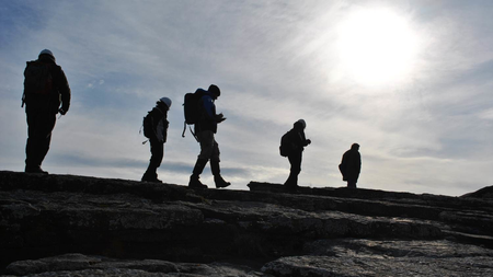
My current research is centred on climate-driven hazards in high-mountain regions, with a particular focus on the Himalaya. I lead a major UKRI-NERC funded project (https://www.abdn.ac.uk/geosciences/departments/planetary-sciences/research/ascertain/) investigating landslide and glacial hazards and their impacts on communities and critical infrastructure.
This project adopts a strongly interdisciplinary approach, integrating geoscience, social science, and stakeholder engagement. By combining satellite Earth Observation data, field-based measurements, and community perspectives, we aim to co-develop mitigation strategies that are both scientifically robust and locally actionable.
A key aspect of this work is direct engagement with policy and practice. I collaborate closely with government agencies, including the Ministry of Earth Sciences in India, as well as regional organisations and local communities. These partnerships ensure that research outputs contribute to decision-making processes related to risk management, infrastructure planning, and climate adaptation.
In parallel, my group is advancing the use of artificial intelligence and high-resolution geospatial data to improve the detection, modelling, and prediction of environmental hazards and complex landscape dynamics.
Past Research
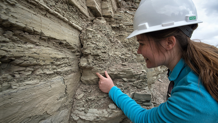
My earlier work has made significant contributions to both Earth and planetary sciences. In high-mountain environments, I have investigated glacier dynamics, avalanche processes, and landscape evolution under changing climatic conditions. I have also played a key role in advancing methodologies in Earth Observation, particularly in the use of UAVs and LiDAR for environmental monitoring. My review papers in this area are among the most widely cited, providing foundational frameworks that have guided subsequent research.
In planetary geomorphology, I have contributed to understanding surface processes on Mars, including providing evidence for transient liquid water and detailed mapping of key landing sites. My involvement in the ExoMars Rover Science Operations Working Group reflects the international recognition of this work and its relevance to planetary exploration.
Knowledge Exchange
A central component of my work is ensuring that research translates into practical outcomes. I actively engage with policymakers, government agencies, and industry stakeholders to ensure that scientific insights inform decision-making processes.
My current work in the Himalaya involves direct collaboration with national-level agencies, including the Ministry of Earth Sciences in India, contributing to the development of risk assessment frameworks and mitigation strategies. I also work with local stakeholders to co-produce knowledge that reflects both scientific evidence and community priorities.
More broadly, I contribute to research funding panels, advisory boards, and international committees, supporting the development of research strategy and policy at national and international levels.
I am committed to communicating science beyond academia and engaging with wider audiences on issues related to climate change and environmental risk. My work has been featured in international media and platforms such as the World Economic Forum, UNDRR, and The Conversation.
I regularly deliver invited talks, public lectures, and participate in international workshops and outreach initiatives. I am also involved in mentoring programmes and educational activities that support students and early-career researchers, including initiatives aimed at widening participation in STEM. Through these activities, I aim to increase awareness of environmental challenges, promote evidence-based understanding, and highlight the role of science in supporting more resilient and sustainable futures.
Collaborations
My research is inherently collaborative and international. I work with partners across Europe, Asia, Africa, North America, and the Middle East, spanning universities, research institutes, and governmental organisations. I have led and coordinated multi-institutional research projects involving interdisciplinary teams, bringing together expertise in geoscience, engineering, data science, and social science. These collaborations enable the development of integrated approaches to complex environmental challenges.
- Teaching
-
Courses
Teaching Responsibilities
GG5067/5068 (ORIGINS, EVOLUTIONS AND IMPLEMENTATION OF GIS): Course Coordinator and Tutor
GG2510 (MAPPING AND MONITORING THE ENVIRONMENT): Course Coordinator and Tutor
GG3069 (REMOTE SENSING AND GEOGRAPHICAL INFORMATION SYSTEMS): Tutor
GL5206/5207 (THE NATURE OF GEOLOGICAL AND GEOGRAPHICAL DATA): Tutor
GL5546 (APPLIED, INDUSTRY AND RESEARCH GEOPHYSICS): Guest Lecturer
GG5910 (DISSERTATION PROJECT IN GIS): Supervision
GL5910 (Dissertation Project in Geophysics): Supervision
- Publications
-
Page 2 of 4 Results 26 to 50 of 96
Using Seismic Data from NASA's InSight Mission to Characterize and Relate Marsquakes with any Identifiable Surface Changes
Contributions to Conferences: Other ContributionsRising winter temperatures might augment increasing wheat yield in Gangetic Plains
Theoretical and Applied Climatology, vol. 150, pp. 1531–1544Contributions to Journals: ArticlesA discussion on the plausible role of ice streams in carving Martian outflow channels: Revisiting the earliest hypothesis by Lucchitta et al. (1981)
Progress in Physical Geography, vol. 46, no. 5, pp. 809-818Contributions to Journals: ArticlesA comprehensive multidecadal glacier inventory dataset for the Chandra-Bhaga Basin, Western Himalaya, India
Working Papers: Preprint Papers- [ONLINE] DOI: https://doi.org/10.5194/essd-2022-311
- [ONLINE] http://dx.doi.org/10.5194/essd-2022-311
Multitemporal glacier inventory revealing four decades of glacier changes in the Ladakh region
Earth System Science Data, vol. 14, no. 9, pp. 4171–4185Contributions to Journals: ArticlesDoes a roosting flock of migratory birds also echelon in high winds?
Journal of ethology, vol. 40, pp. 291–296Contributions to Journals: ArticlesEditorial:: Applications of Remote Sensing in Glaciology
Remote Sensing, vol. 14, no. 17, 4146Contributions to Journals: ArticlesEditorial: Advances in Mars Research and Exploration
Frontiers in Astronomy and Space Sciences, vol. 9, 971104Contributions to Journals: ArticlesPolar and Cryospheric Remote Sensing Using sUAS
sUAS Applications in Geography. Konsoer, K., Leitner, M., Lewis, Q. (eds.). 1 edition. Springer Nature Switzerland AG, pp. 235-261, 27 pagesChapters in Books, Reports and Conference Proceedings: Chapters- [ONLINE] DOI: https://doi.org/10.1007/978-3-031-01976-0_9
Visualising avalanches in the Himalayas
Royal Geographical Society with Institute of British Geographers.Other Contributions: Other ContributionsLong-term spatiotemporal variability in the surface velocity of Eastern Himalayan glaciers, India
Earth Surface Processes and Landforms, vol. 47, no. 7, pp. 1720-1733Contributions to Journals: Articles- [ONLINE] DOI: https://doi.org/10.1002/esp.5342
- [OPEN ACCESS] http://aura.abdn.ac.uk/bitstreams/3805a54e-2b95-4538-8b4c-341f5fec587d/download
- [ONLINE] View publication in Scopus
Spatiotemporal quantification of key environmental changes in Stok and Kang Yatze regions of Ladakh Himalaya, India
Geocarto International, vol. 37, no. 26, pp. 11509–11533Contributions to Journals: ArticlesAutomated Delineation of Supraglacial Debris Cover Using Deep Learning and Multisource Remote Sensing Data
Remote Sensing, vol. 14, no. 6, 1352Contributions to Journals: Articles- [ONLINE] DOI: https://doi.org/10.3390/rs14061352
- [OPEN ACCESS] http://aura.abdn.ac.uk/bitstreams/d6eb5e9d-b64e-499f-8e86-ad464c00d209/download
- [ONLINE] View publication in Scopus
How satellites are helping us to understand deadly avalanches
The ConversationContributions to Specialist Publications: ArticlesReconstruction and Characterisation of Past and the Most Recent Slope Failure Events at the 2021 Rock-Ice Avalanche Site in Chamoli, Indian Himalaya
Remote Sensing, vol. 14, no. 4, 949Contributions to Journals: ArticlesA Remote Sensing Perspective on Mass Wasting in Contrasting Planetary Environments: Cases of the Moon and Ceres
Remote Sensing, vol. 14, no. 4, 1049Contributions to Journals: Articles- [ONLINE] DOI: https://doi.org/10.3390/rs14041049
- [OPEN ACCESS] http://aura.abdn.ac.uk/bitstreams/6fe2f4bf-3cce-481e-9922-9dc6ab21a9ce/download
- [ONLINE] View publication in Scopus
Tackling the global change challenges to water security in Tajikistan, the water tower of Central Asia
EGU General Assembly 2022Contributions to Conferences: Abstracts- [ONLINE] DOI: https://doi.org/10.5194/egusphere-egu22-6024
Brine-Induced Tribocorrosion Accelerates Wear on Stainless Steel: Implications for Mars Exploration
Advances in Astronomy, vol. 2021, 6441233Contributions to Journals: ArticlesFour decades of understanding Martian geomorphology: Revisiting Baker’s ‘The geomorphology of Mars’
Progress in Physical Geography, vol. 45, no. 6, pp. 979-989Contributions to Journals: ArticlesModelling Permafrost Distribution in Western Himalaya Using Remote Sensing and Field Observations
Remote Sensing, vol. 13, no. 21, 4403Contributions to Journals: ArticlesLocal- and Regional-Scale Forcing of Glacier Mass Balance Changes in the Swiss Alps
Remote Sensing, vol. 13, no. 10, e1949Contributions to Journals: ArticlesA Comparative View of Glacial and Periglacial Landforms on Earth and Mars
Bulletin of the AAS, vol. 53, no. 4Contributions to Journals: ArticlesMars Astrobiological Cave and Internal habitability Explorer (MACIE): A New Frontiers Mission Concept
Bulletin of the AAS, vol. 53, no. 4, 347Contributions to Journals: ArticlesSolar-System-Wide Significance of Mars Polar Science
Bulletin of the AAS, vol. 53, no. 4Contributions to Journals: ArticlesSubsurface robotic exploration for geomorphology, astrobiology and mining during MINAR6 campaign, Boulby Mine, UK: part II (Results and Discussion)
International Journal of Astrobiology, vol. 20, no. 1, pp. 93-108Contributions to Journals: Articles