
Interdisciplinary Fellow
- About
-
- Email Address
- william.harcourt@abdn.ac.uk
- Office Address
- School/Department
- School of Geosciences
Biography
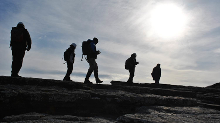
I am an Interdisciplinary Fellow at the University of Aberdeen. Will's research interests span across multiple disciplines, focusing primarily on the cryosphere, Earth Observation (EO) and Artificial intelligence (AI). Geographically, I primarily work in the Arctic, particularly in Svalbard and Greenland, but also conduct research in other locations across the Arctic and closer to home, such as in Scotland. I have an interest in studying glacier instabilities, such as glacier surges, to better understand the fundamental physics that drive glacier flow. I use remote sensing instruments and geophysical sensors to understand these processes and combine them using AI methods to build digital twins of the environment, currently with a focus on Svalbard. I try to leave the office to work in the field and I have led and participated in several expeditions to locations such as Svalbard, Iceland, the European Alps, the Scottish Highlands and locally within the UK.
Before this, I graduated from the University of Exeter with a 1st Class Honours degree in Geography before moving to the University of Edinburgh to study for a MSc in Geographical Information Science (GIS). Between 2017 and 2018, I was a Research Assistant at Edinburgh Napier University, leading the first ever national scale analysis of seagrass change in the world. In 2022, he completed a PhD at the University of St Andrews where he developed millimetre-wave radar as a tool for mapping and monitoring glaciers. I then joined the University of Aberdeen in 2022 as a Lecturer before starting the interdisciplinary research fellowship in 2023.
Qualifications
- BSc Geography2016 - University of Exeter
- MSc Geographical Information Science (GIS)2017 - University of Edinburgh
- PhD Physics2022 - University of St Andrews
External Memberships
- International Glaciological Society (IGS)
- European Geosciences Union (EGU)
- Royal Geographical Society (RGS)
- Scottish Alliance for Geoscience, Society and Society (SAGES)
- NERC Peer Review College Member
- Research
-
Research Overview
My research is highly interdisciplinary and covers subject areas in geographical sciences, computer sciences, physics and more! My research can be grouped into three main area:
Glacier Surges
- Surges are quasi-periodical cycles of fast and slow. Such glaciers are clustered in geographical locations, suggesting their is a shared driver.
- I have a strong interest in understanding Arctic surge-type glaciers, particularly in Svalbard where surge-type glaciers are particularly well studied.
- Quantifying glacier surge behaviour and their driving processes (e.g. basal sliding, energy build-up and release, impacts on mass balance).
Tidewater Glacier Dynamics
- Iceberg Calving: The process of iceberg calving and its contribution to mass loss across the Arctic. Measuring this process and analysing its drivers.
- Response to Climate Change: Quantifying the long-term impact of climate change on tidewater glacier dynamics and mass balance
Arctic Cryosphere
- I have a strong interest in the wider cryosphere across the Arctic, particularly in Svalbard, Greenland and the Canadian Arctic.
- Sea ice dynamics and relationships to shipping activity, particularly through the development of new data products and assisting end-users with real-time sea ice data.
- Measuring and monitoring snow cover across the Arctic and in Scotland.
Digital Twins
- Developing digital twins for chaotic environment systems such as glaciers (e.g. Svalbard, the Greenland Ice Sheet)
- Observing Systems: Construction of inter-connected systems to observe environmental processes and document their changes over time.
Remote Sensing/Earth Observation (EO)
- Remote Sensing: Development of different sensors and techniques for mapping/monitoring environmental systems, particularly glaciers.
- Earth Observation: Harnessing large-scale satellite data for regional/global analysis of the Earth system.
- Data Science and Statistics: Development of data processing/analysis techniques for understanding environmental systems, error/uncertainty in environmental data.
Applications of AI in Cryospheric Science
- Machine learning: Application of Artificial Intelligence (e.g. Machine Learning and Deep Learning) to study environmental systems (e.g. glaciers), often using remote sensing data.
- Foundation models: Large-scale, pretrained models that can be fine-tuned using domain specific data sets.
- Image segmentation: Developing new methods for classifying cryosphere features in satellite imagery such as sea ice, snow, glacier surface features (e.g. crevasses).
Research Areas
Accepting PhDs
I am currently accepting PhDs in Geography and Environment, Computing Science.
Please get in touch if you would like to discuss your research ideas further.
Research Specialisms
- Glaciology and Cryospheric Systems
- Machine Learning
- Remote Sensing
Our research specialisms are based on the Higher Education Classification of Subjects (HECoS) which is HESA open data, published under the Creative Commons Attribution 4.0 International licence.
Funding and Grants
A full list of successful grants as PI or Co-I from 2019 can be found here: https://williamharcourt.co.uk/grants/
Datasets
-
"03_Ortho_Forefield_Subset.tif", Drone-based mapping of calving rates of Borebreen in Svalbard
This file is part of "Drone-based mapping of calving rates of Borebreen in Svalbard".- DOI
- 10.18710/b553mb/q1w9t0
- Publisher
- DataverseNO
-
"03_Ortho_20230809_Glacier.tif", Drone-based mapping of calving rates of Borebreen in Svalbard
This file is part of "Drone-based mapping of calving rates of Borebreen in Svalbard".- DOI
- 10.18710/b553mb/snypu0
- Publisher
- DataverseNO
-
"03_Ortho_Forefield.tif", Drone-based mapping of calving rates of Borebreen in Svalbard
This file is part of "Drone-based mapping of calving rates of Borebreen in Svalbard"- DOI
- 10.18710/b553mb/8azv81
- Publisher
- DataverseNO
-
Drone-based mapping of calving rates of Borebreen in Svalbard: 02_DEM_20230801_Glacier.tif
:unav- DOI
- 10.18710/b553mb/yytqm5
- Publisher
- DataverseNO
-
"03_Ortho_20230808_Glacier.tif", Drone-based mapping of calving rates of Borebreen in Svalbard
This file is part of "Drone-based mapping of calving rates of Borebreen in Svalbard".- DOI
- 10.18710/b553mb/og4oh7
- Publisher
- DataverseNO
-
"03_Ortho_20230811_Glacier_Subset_B.tif", Drone-based mapping of calving rates of Borebreen in Svalbard
This file is part of "Drone-based mapping of calving rates of Borebreen in Svalbard".- DOI
- 10.18710/b553mb/0spl08
- Publisher
- DataverseNO
-
"01_Images_20230808.zip", Drone-based mapping of calving rates of Borebreen in Svalbard
This file is part of "Drone-based mapping of calving rates of Borebreen in Svalbard".- DOI
- 10.18710/b553mb/cfk0x8
- Publisher
- DataverseNO
-
"03_Ortho_20230812_Glacier.tif", Drone-based mapping of calving rates of Borebreen in Svalbard
TIFF Image- DOI
- 10.18710/b553mb/vgv45b
- Publisher
- DataverseNO
-
Drone-based mapping of calving rates of Borebreen in Svalbard
This database contains drone-based mapping data of the crevassed and surging glacier of Borebreen in Svalbard, Norway. The dataset was generated using a structure-from-motion (SfM) method using drone-based imagery. The data was processed with Agisoft...- DOI
- 10.18710/b553mb
- Publisher
- DataverseNO
-
Drone-based mapping of calving rates of Borebreen in Svalbard: 02_DEM_Forefield.tif
1.0- DOI
- 10.18710/b553mb/bbirof
- Publisher
- DataverseNO
-
Drone-based mapping of calving rates of Borebreen in Svalbard: 03_Ortho_20230811_Glacier.tif
- DOI
- 10.18710/b553mb/rvo5if
- Publisher
- DataverseNO
-
Drone-based mapping of calving rates of Borebreen in Svalbard: 02_DEM_20230808_Glacier.tif
- DOI
- 10.18710/b553mb/u4n9sh
- Publisher
- DataverseNO
-
"02_DEM_20230811_Glacier_Subset_A.tif", Drone-based mapping of calving rates of Borebreen in Svalbard:
This file is part of "Drone-based mapping of calving rates of Borebreen in Svalbard".- DOI
- 10.18710/b553mb/abwhwf
- Publisher
- DataverseNO
-
Svalbard Surge Database 2024 (RGI2000-v7.0-G-07)
We have developed a new database of surge-type glaciers in Svalbard by combining existing compilations and reviewing studies examining their dynamics. Our database is based upon the Global Land and Ice Measurements from Space (GLIMS) database (König ...- DOI
- 10.5281/zenodo.15240754
- Publisher
- Zenodo
- Teaching
-
Programmes
- Undergraduate, 4 year, September start
- Undergraduate, 4 year, September start
- Postgraduate, 3 year, September start
- Postgraduate, 3 semester, September start
- Postgraduate, 3 stage, January start
- Postgraduate, 3 stage, January start
Courses
- Publications
-
Page 2 of 3 Results 11 to 20 of 23
94 GHz Radar Backscatter Characteristics of Alpine Glacier Ice
Geophysical Research Letters, vol. 50, no. 21, e2023GL104721Contributions to Journals: ArticlesHansbreen’s calving-driven ice loss derived from seismic data supported by millimetre-wave radar scans and neural networks
EGU General Assembly 2022, pp. EGU22-4179Contributions to Conferences: AbstractsWhere to fish in the forest?: Tree characteristics and contiguous seagrass features predict mangrove forest quality for fishes and crustaceans
Journal of Applied Ecology, vol. 60, no. 7, pp. 1340-1351Contributions to Journals: ArticlesGlacier monitoring using real-aperture 94 GHz radar
Annals of Glaciology, vol. 63, no. 87-89, pp. 116-120Contributions to Journals: Articles- [ONLINE] DOI: https://doi.org/10.1017/aog.2023.30
- [OPEN ACCESS] http://aura.abdn.ac.uk/bitstreams/1b9f6a97-0f5b-43a1-b309-871e26ce6711/download
- [ONLINE] View publication in Scopus
Assessment of ice mélange impacts on tidewater glacier dynamics using high resolution ICEYE imagery
Contributions to Conferences: Oral PresentationsMillimetre-wave radar observations of glacier calving at Hansbreen (Svalbard) correlated with TLS, time-lapse camera images and seismic records
Contributions to Conferences: Oral PresentationsSIOS’s Earth observation and remote sensing activities toward building an efficient regional observing system in Svalbard
Contributions to Conferences: Oral PresentationsObserving iceberg size distributions and implications for calving processes
EGU General Assembly 2022, pp. EGU22-9298Contributions to Conferences: Abstracts94 GHz radar mapping of terrestrial snow cover
vEGU21, pp. EGU21-2747Contributions to Conferences: AbstractsANALYSIS OF FILTERING TECHNIQUES FOR INVESTIGATING LANDSLIDE-INDUCED TOPOGRAPHIC CHANGES IN THE OETZ VALLEY (TYROL, AUSTRIA)
ISPRS Annals of the Photogrammetry, Remote Sensing and Spatial Information Sciences, vol. 2, pp. 719-726Contributions to Journals: Articles