Understanding volcanic eruptions with thermal imaging
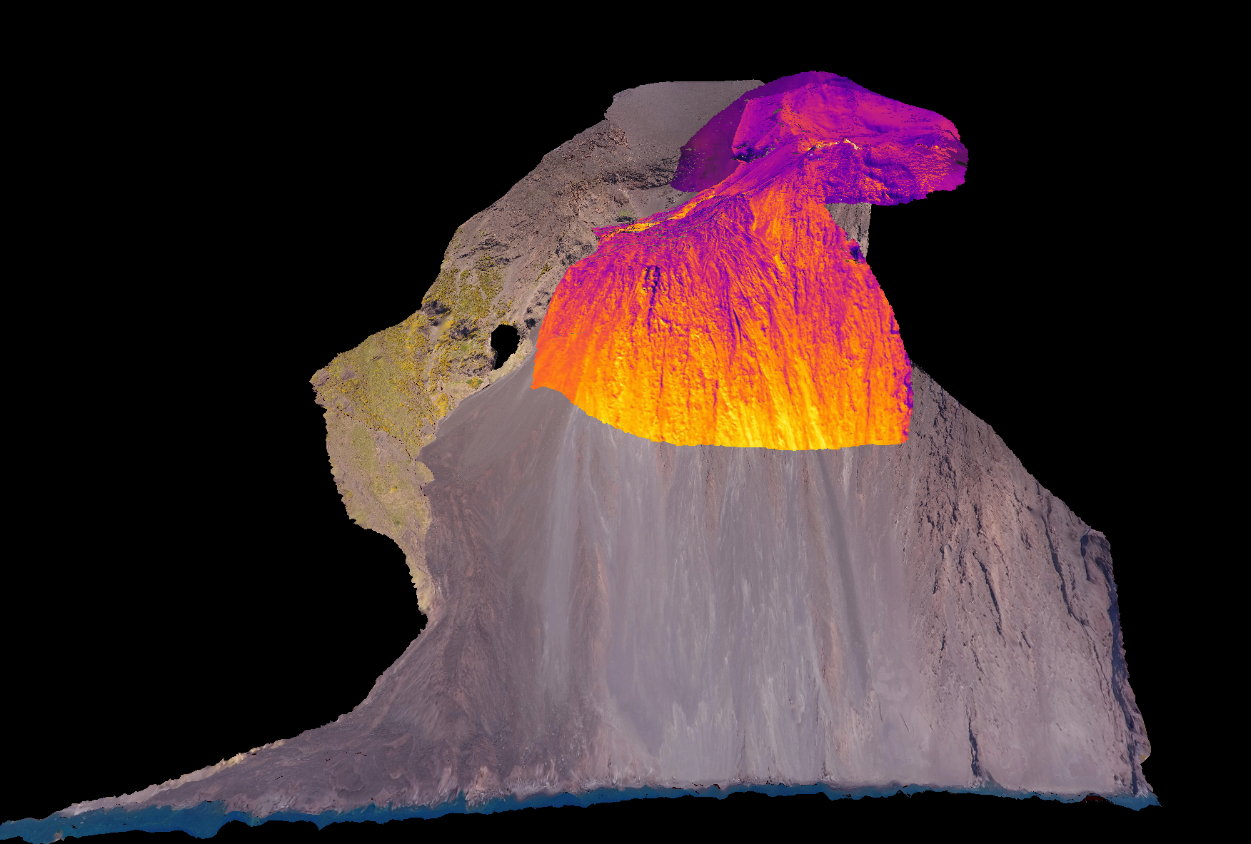
Our researchers have created the world's first 3D thermal image of an active volcano.
Around the world, 500 million people live within the shadow of active volcanoes. Predicting the timing of volcanic eruptions is very difficult, but their impact on the local communities can be catastrophic.


Current methods for monitoring activity and predicting eruptions are also costly, involving networks of expensive technology and equipment such as seismometers that listen for minute tremors in the ground, detectors that sense changes in the gases emitted by the volcano and arrays of sensors that use GPS and tilt meters to record subtle changes in the volcano’s surface.
Many of the world’s most dangerous volcanoes lie within poor nations, but this equipment is typically only available in developed countries, which means millions of people are exposed to potential harm with little or no warning.
Testing new methodologies
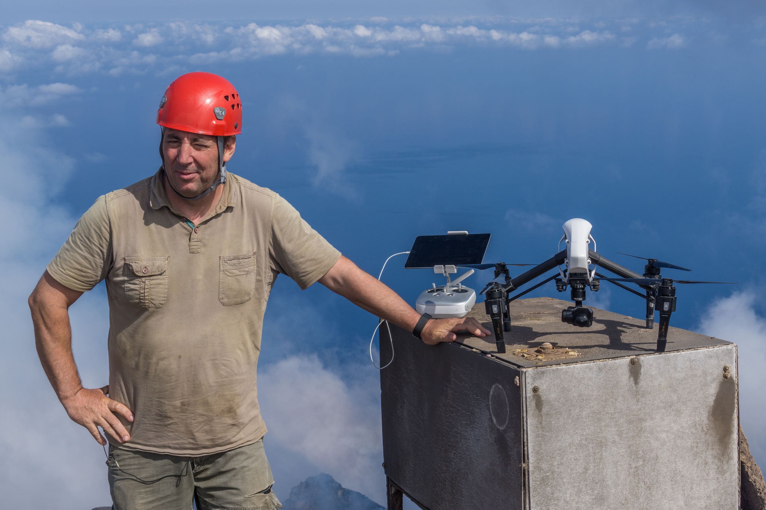
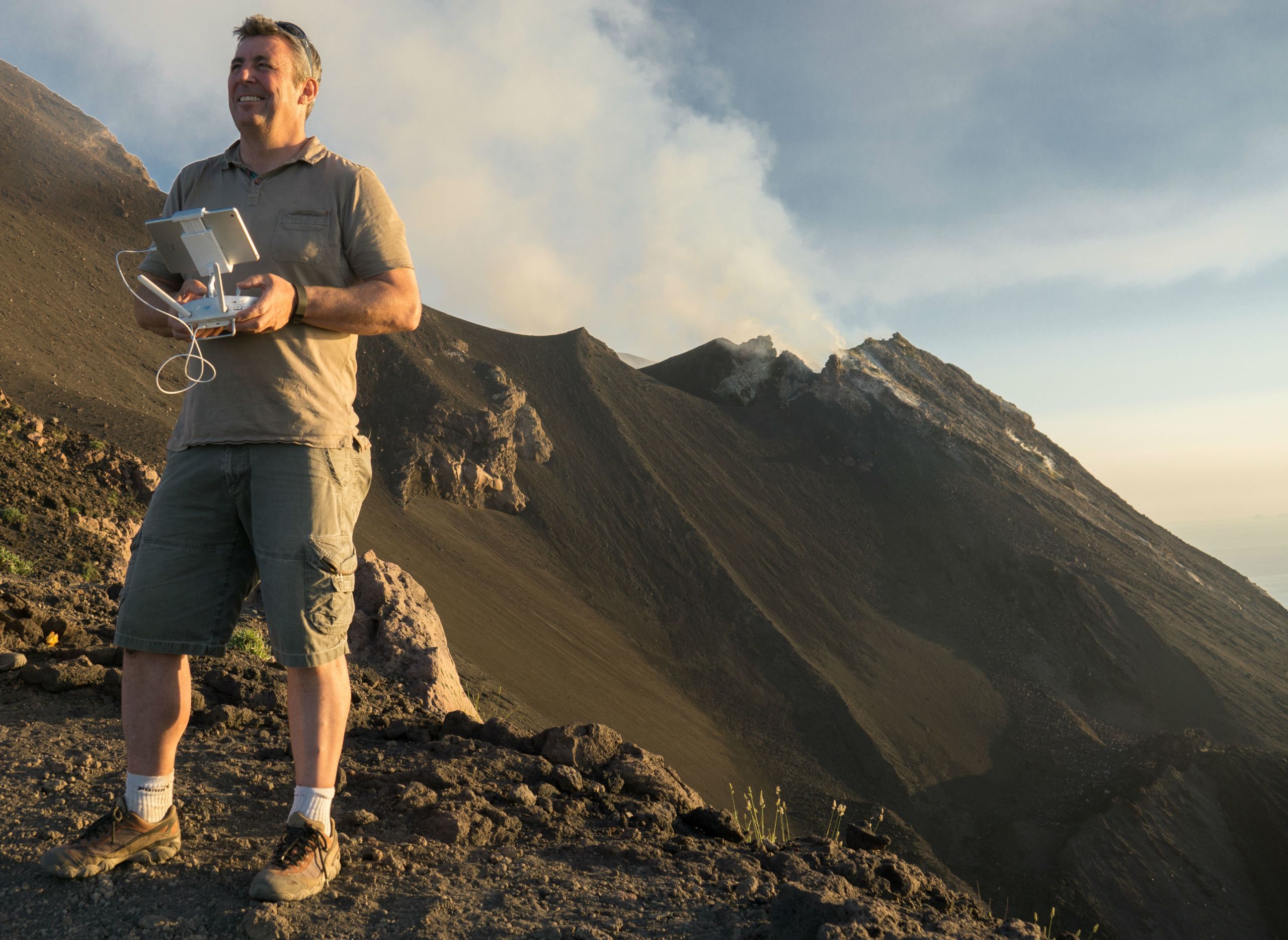
Led by Professor John Howell, a team of scientists from the Universities of Aberdeen and Oslo are using a combination of drone and thermal imaging technologies to develop a new, low-cost monitoring system that can be applied anywhere in the world.
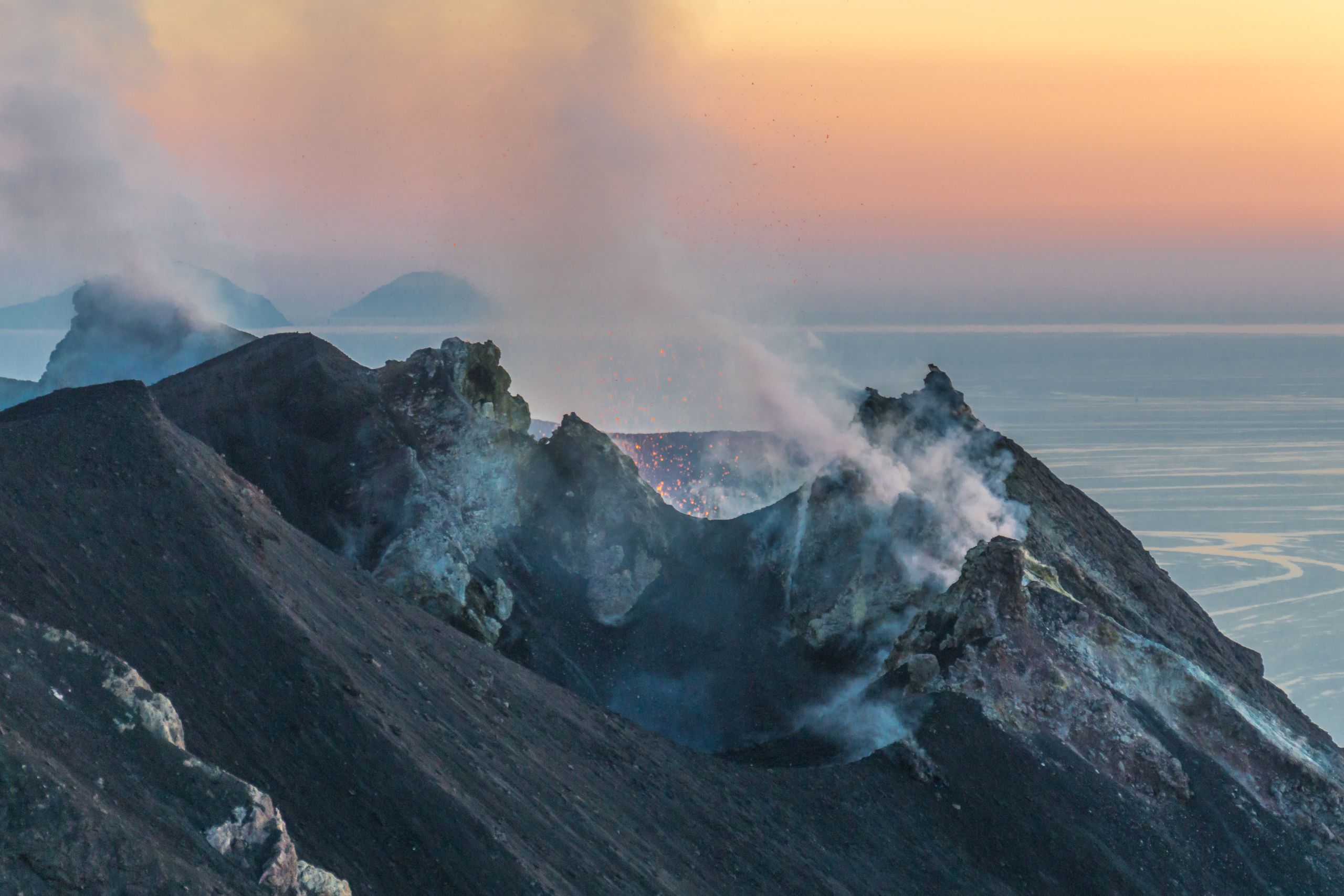
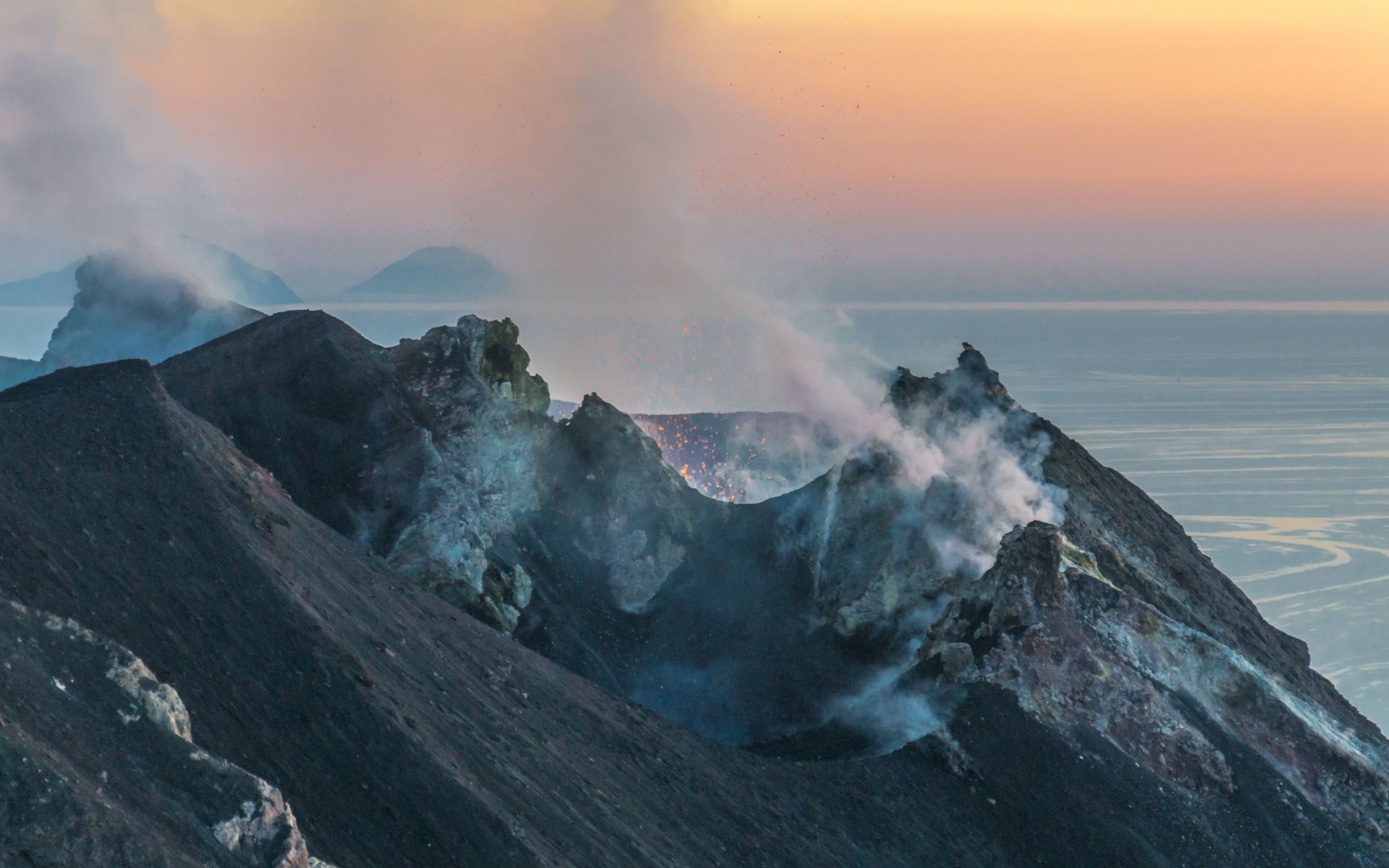
To test this new methodology, the team flew drones over Stromboli, Europe’s most active volcano, which lies in the Mediterranean off the southern tip of Italy. Stromboli provided an ideal testing ground because it is covered with an advanced network of monitoring equipment which can be used to calibrate results of the new methodologies. Stromboli has minor eruptions several times every hour, with large eruptions occurring approximately every ten years - the most recent on July 3rd 2019.
Drones and thermal imaging


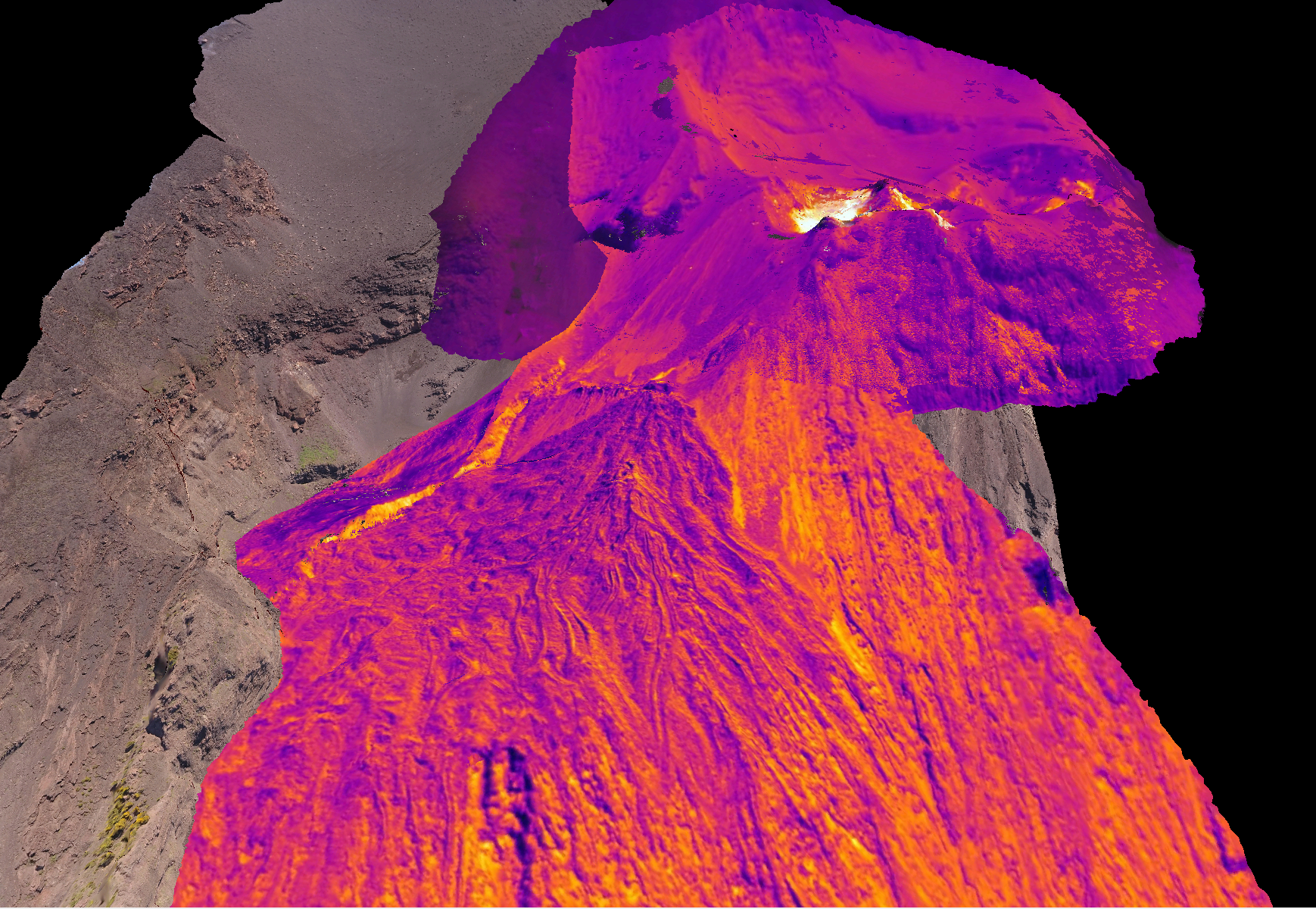
In the last few years, the rapid evolution of drone technology has led to a transformation in the way geologists study the Earth’s surface. The University of Aberdeen’s team has been at the forefront of developing methods for building 3D computer visualisations of cliffs and landscape, which rely on capturing thousands of images from different positions and stitching them together into a 3D model.
These technologies have direct application to volcanoes, especially when coupled with thermal imaging – a technique that involves taking pictures that automatically record temperature.
To utilise this technique, two drones were flown across the volcano; the first was mounted with a high-resolution camera that takes normal photographs and the second was mounted with a thermal camera.
Over the course of several days, 20 flights captured high-precision data which was then processed by the team. The data provided an extremely high-resolution map of the surface of the volcano which was overlain with thermal images and resulted in the world’s first 3D thermal model of a volcano.


“Looking to the future, repeated and regular gathering of thermal imaging data from the same area could be used to look for changes in a volcano.
Swelling and heating of the ground are both signs of impending eruptions and, if detected, could allow enough time for warning and evacuation.
Once proven, these systems could be deployed to potentially active volcanoes around the world at a fraction of the cost of conventional monitoring systems, and would provide a safer, cheaper and more accurate method for detecting early warning signs of volcanic eruptions.”

Impact
- Research created world’s first 3D thermal image of an active volcano
- Future development of the technology could provide a low-cost monitoring system, which could be deployed around the world and has the potential to save thousands of lives
- Results of the project have been used in numerous science outreach programs including a 20-minute documentary and a TedX talk.


