Recent hydrocarbon exploration activity has focussed on basins with significant igneous activity such as the Faeroe-Shetland Basin (FSB) and offshore Greenland. A significant challenge in exploration of these Large Igneous Provinces (LIP’s) results from difficulties with seismic imaging and a consequent lack of stratigraphic control. Previous work in LIP’s has focussed largely on geochemical characterisation with some volcanic stratigraphy and has not considered the relationship between volcanism and clastic sedimentation. Importantly, volcanic stratigraphy and clastic sedimentation are intimately linked and must be considered as part of a single evolving system. To facilitate hydrocarbon exploration and exploitation in LIP’s it is necessary to have predictive models of reservoir development and distribution, yet none are available at present. To rectify this, it is necessary to map clastic sediment distribution in modern and ancient volcanic terrains. Such studies need to be multidisciplinary, constrained by a well defined chronostratigraphic framework and integrate all available information including palaeo-environmental data from biofacies, provenance and catchment size, associated volcanic stratigraphy and facies.
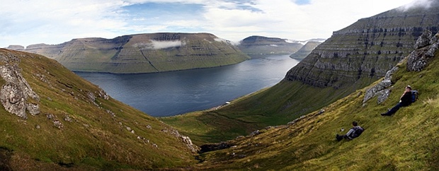
Field work on the Enni Formation lava sequence, Faroe Islands
Predictive Model for the Stratigraphic Evolution of LIP's
Work on different LIP’s by members of the StratLIP group suggests that a preliminary predictive stratigraphic model for LIP development can be established:
- Initial LIP development: significant volcanic activity and fault activity restricted to isolated volcanic centres. Local volcaniclastic input adjacent to volcanic centres but with small drainage networks. Existing (clastic) fluvial systems will be deflected away from volcanic centre, but be unaffected elsewhere. Pillow lavas and hyaloclastites in lakes and adjacent to shorelines. Faulting may result in deflection of drainage producing lake (continental setting) or depending on nature of shoreline (embayed or not) may produce estuaries with tidal influence (shallow marine) or a wave-dominated system. Implications: Significant possibility of clastic reservoirs between early volcanic centres, distribution will depend on fault activity.
- Mid LIP development: thermal uplift and main period of volcanic activity. Lavas swamp all drainage systems creating new topography and damming valleys. Isolated (tuffaceous) lakes developed on and between lava flows. Pillow lavas and hyaloclastites in marine or lacustrine settings. Fluvial systems restricted to the edge of the lava pile. Volcaniclastic dominated fluvial systems within the LIP. Implications: Clastic reservoirs restricted to flanks of lava pile.
- Late LIP development: decrease in eruptive activity, dominance of erosional processes and thermal subsidence. Drainage systems largely sourced from volcanic edifices (highest points) producing volcaniclastic material. Decrease in fault activity. Onlap of sedimentary systems onto volcanic edifices, likely to be a regional transgression so may move from fluvial to shallow marine environments. Possible unroofing of plutonic material. Implications: Stratigraphic traps through fluvial/shallow marine reworking of material along flanks and over the top of the lava pile, and onlap as edifice subsides/sediment accumulates. Plutonic (granitic) material may provide reasonable reservoir sands. Reservoir quality affected by volcaniclastic material.
 |
 |
|
Field photographs of clastic fluvial sediments interbedded with basalts in the lower 130 m of the Skye Main Lava Series. Note the lack of volcanic material and clastic matrix. Section on the left is 10 m thick and consists of a series of three conglomerate bodies interbedded with thin sandstones, shales and coals bounded by basaltic lava flows (contacts show as white lines). The photo on the right is taken from 3 m above the base of the conglomerate package and is marked by the white arrow. Note the dominance of brown ‘Torridonian’ sandstone clasts and lack of volcanic clasts. |
|
|
|
Example of externally sourced clastic fluvial system (blue) traversing active (yellow) and older (mauve) basaltic lava fields during the early stages of LIP development, Ethiopia. |
